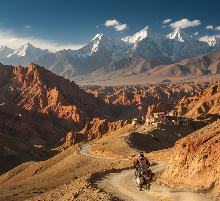

Nepal Trekking Safety High Alert: Westerly Winds 2025 late October— What Trekkers Must Know !
Nepal Trekking Safety Alert.
Nepal’s National Disaster Risk Reduction & Management Authority (NDRRMA) has issued a Nepal trekking safety alert due to a stream of westerly winds bringing unstable mountain weather across popular Himalayan routes. Authorities are urging trekkers to check forecasts carefully, avoid solo travel, and plan conservatively after recent fatalities reported in Manang and Kaski.
This post explains, in plain language, what westerly systems are, why they matter for high-altitude routes, and how to prepare safely this week. You’ll find a region-by-region watchlist, a practical pre-trek checklist, on-trail protocols, clear thresholds for postponing, and expert field tips. Our goal is not to alarm you but to inform and reassure—so you can make calm, confident decisions on your trek.
What Are Westerly Winds?
“Westerlies” are large-scale wind patterns that push moisture and cold air from the west toward the Himalaya. When these systems interact with steep terrain and high passes, they can create rapid weather shifts:
Sudden snowfall & whiteouts: Visibility can drop from kilometers to meters within minutes, obscuring cairns and trail markers.
Windchill & frost risk: Strong winds at altitude drastically reduce perceived temperature, increasing the risk of hypothermia.
Cornices & avalanche concerns: Fresh wind-loaded snow can form unstable slabs near ridgelines and passes.
Icing and slick surfaces: Melt-freeze cycles create treacherous ice on stone steps and traverses.
High, exposed passes—Thorong La (Annapurna Circuit), Larkya La (Manaslu), Mardi Ridge (Annapurna Sanctuary/Mardi), Cho La and Kongma La (Everest)—are especially vulnerable. When forecasts show strong westerlies, treat pass days with extra caution or delay.
Official Guidance from NDRRMA
NDRRMA’s advisory can be summarized into the following practical actions:
Check forecasts twice daily (evening and early morning) and verify locally with lodges and guides.
Avoid solo trekking. Travel with a partner or, preferably, a licensed guide who understands local microclimates and alternative routes.
Ensure permits and registrations are in order (TIMS where applicable; conservation/park permits such as ACAP/MCAP).
Carry reliable communication (satellite messenger, radio where available, fully charged phone + power bank).
Plan conservative itineraries: Add buffer days; prefer earlier starts; shorten summit/pass ambitions if winds build.
Record intentions: Tell your lodge and guide your plan, expected arrival time, and emergency contacts before setting off.
This isn’t about fear—it’s about margin. The more margin you build into your plan, the safer and more enjoyable your trek becomes.
Region-by-Region Watchlist
Manang (Annapurna Circuit)
Key exposure: Thorong La (5,416 m)—broad, wind-swept terrain where gusts and wind-loaded snow can develop quickly.
What to watch: Morning whiteouts, drifting snow, ice on the upper traverse above Thorong Phedi/High Camp; teahouse closures early/late season.
Field tip: If the wind is already fierce at High Camp before dawn, delay. The pass will be worse.
Kaski (Annapurna Sanctuary / Mardi Region)
Key exposure: Ridge lines above 3,500 m (Mardi Ridge, ABC approach near Deurali–Macchapuchhre Base Camp).
What to watch: Fresh snow on steep gullies, poor visibility in the Sanctuary bowl, and cornice formation along airy ridges.
Field tip: Carry goggles for spindrift; protect face and fingers—windchill bites fast in this basin.
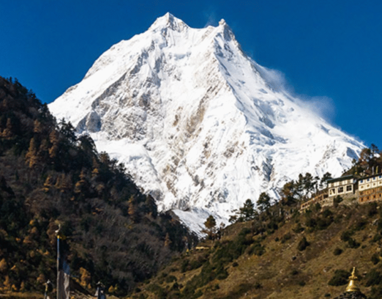
Manaslu
Key exposure: Larkya La (5,160 m)—a long, committing approach where early starts and steady pacing are essential.
What to watch: Wind slabs near the top, icy undulations on the descent to Bimthang, and limited shelter between high camps.
Field tip: If winds exceed safe limits or visibility collapses, retreat to last safe lodge and reassess with your guide as safety precaution during Manaslu trek.
Langtang
Key exposure: Above Kyanjin Gompa—Tserko Ri and surrounding ridges.
What to watch: Blowing snow that obscures cairns and tracks; rapidly changing visibility.
Field tip: Use waypoints and turn-around times. If you lose the trail, stop, regroup, and backtrack to known features.
Everest Region (Khumbu)
Key exposure: High passes (Cho La/Kongma La/Renjola), upper Kala Patthar, exposed traverses toward Gokyo.
What to watch: Polished ice on boulder fields and pass approaches, high windchill.
Field tip: On pass circuits, build two buffer days into your itinerary so you’re not forced over in marginal weather.
Pre-Trek Checklist
Weather Intelligence
Review national bulletins (evening + morning) and compare with local lodge reports.
Ask your guide about recent pass conditions, snow depth, and any closures.
Build contingency days into your itinerary; don’t aim pass days back-to-back.
Permits & Registration
Confirm route-specific permits (e.g., ACAP/MCAP, national park fees, TIMS where applicable).
Keep hard copies and phone photos of all documents; store a copy with your lodge/guide.
Insurance & Evacuation
Buy insurance that explicitly covers high-altitude trekking and helicopter evacuation.
Save policy details and emergency numbers in your phone and on paper; share with your guide.
Emergency Contacts
Note your embassy/consulate contacts, your insurer’s claim hotline, and local rescue coordination contacts (your outfitter/guide will provide current numbers).
Agree on a check-in schedule (e.g., 18:00 daily) with someone at home.
Gear for Westerly Conditions
Goggles (or wraparound sunglasses with side shields) for spindrift/whiteout.
Face protection: buff/balaclava + windproof cap/hood.
Insulation: a real midlayer (fleece) and belay jacket (down/synthetic).
Shell: waterproof/windproof jacket & pants.
Hands: liner gloves + insulated gloves/mitts (carry spares).
Footing: microspikes or light traction if ice is expected.
Navigation: GPS app with offline maps + power bank; paper map & compass as backup.
Comms: satellite messenger (Garmin inReach/Spot) or radio where available.
Headlamp with fresh batteries (whiteouts can force night-like visibility mid-day).
Fitness, Pacing & Health
Adopt a slow-start strategy the first 2–3 days; protect your pass day.
Hydrate (3–4 L/day with electrolytes) and snack every 60–90 minutes.
Set turn-around times (e.g., 10:30–11:00 for passes in shoulder seasons).
On-Trail Protocols
Group Spacing & Communication
Maintain visual contact; in blowing snow, shorten spacing to voice distance.
Assign a lead (route finding) and sweep (keeps group together).
Every 30–45 minutes: quick check—hydration, layers, fingers, toes, morale.
Navigation in Poor Visibility
Use recorded waypoints and stick to known lines; don’t shortcut switchbacks.
If markers vanish: stop, regroup, backtrack to last known waypoint.
Avoid lingering under wind-loaded slopes and corniced ridges.
Decision Points & Turn-Back Triggers
If wind exceeds safe limits, visibility drops to a few meters, or you’re behind the turn-around time, turn back. The mountain is not going anywhere.
If a team member is flagging, shorten the day or retreat—fatigue compounds risk in wind and snow.
Altitude Illness Refresher (AMS)
Early signs: persistent headache, nausea, unusual fatigue, poor coordination, insomnia.
Response: Rest, hydrate, consider descent. If symptoms worsen with ascent, descend immediately and inform your guide.
Medication: Discuss acetazolamide (Diamox) with your doctor in advance; do not use drugs to mask deteriorating symptoms.
When to Postpone
You don’t “win” by forcing a pass in marginal weather. Postpone if any of the following apply:
Forecasted heavy snowfall or storm warnings along your route.
Sustained ridge/pass winds above ~60–70 km/h (higher gusts demand even more caution).
Closed teahouses or rescue advisories indicating limited shelter or support.
Multiple incident reports on your intended pass from the last 48–72 hours.
A 24–48 hour delay can be the difference between a grim sufferfest and a gorgeous, safe crossing.
Local Voices
“Westerly pulses can turn Larke – La ( Manaslu Circuit Trek) from ‘bluebird’ to zero visibility in under an hour. If High Camp is howling at dawn, we wait.”
— Kiran Basnet, licensed guide, Manaslu circuit.
“On Mardi Ridge, the wind funnels right along the crest. Goggles and a solid shell save the day—and spare gloves are gold.”
— Laxmi Rana, lodge owner, Kaski
Useful Links
Manaslu Trek Fitness & Acclimatization (2026–2027) → /manaslu-trek-fitness-acclimatization/
Annapurna Permits & TIMS Guide → /annapurna-permits-tims/
Trekking Insurance & Helicopter Evacuation Explained → /insurance-and-evacuation-nepal-treks/
Essential Packing List for Nepal Treks → /nepal-trek-packing-list/
How to Choose a Licensed Trekking Guide in Nepal → /choose-licensed-guide-nepal/
CTA — Stay Informed, Trek Confident
Subscribe for real-time weather and trail updates from TravellingNepal.com.
Download our 1-page Weather Safety Checklist (PDF)—perfect for your phone or map case.
Book a guided trek with our vetted partners for safer logistics and decision-making during westerly wind windows.
Safety Box
Weather: Check national bulletins morning/evening; confirm with lodges/guides.
Comms: Carry a satellite messenger; share your itinerary.
Permits: ACAP/MCAP/TIMS (where applicable)—carry copies.
Insurance: Must include high-altitude trekking & heli evacuation.
Emergency Plan: Daily check-ins, turn-around times, nearest safe lodges identified.
FAQ
Is it safe to trek now?
It can be, with conservative planning. Follow forecasts closely, build buffer days, and avoid solo travel. If winds or visibility deteriorate, delay or turn back.
How do I check forecasts?
Use national bulletins and local lodge/guide reports. Compare evening looks (for next day’s plan) with pre-dawn updates (go/no-go at breakfast).
What if a lodge is closed?
Do not commit to a long, exposed section without confirmed open lodging at the far end. Backtrack to the last reliable teahouse or wait for improving conditions.