Tatopani Border Crossing Reopens After Month-Long Landslide Blockage on Araniko Highway
Nepal’s key overland trade route to China partially reopened on Monday, August 25, 2026, after a month-long landslide blockage forced the closure of the Tatopani border crossing along the Araniko Highway in Sindhupalchok district. Vehicular traffic resumed along the Eco section of the highway after the Road Division Office deployed heavy machinery to carve out a temporary single-lane track, allowing stranded cargo containers to move toward the customs office at Duguna in Bhotekoshi Rural Municipality.
The reopening is a relief for traders and transporters who have been stranded for weeks, but the border crossing remains only partially operational. Severe road subsidence at Liping and a fresh landslide on the Chinese side of the border continue to block full cross-border movement, leaving approximately 85 containers still stuck across the border.

Table of Contents
- What Happened: A Month of Blockage
- The Araniko Highway: Nepal’s Overland Link to China
- Current Road Status: What’s Open and What’s Not
- Impact on Travelers and Trade Ahead of Dashain
- Why This Route Is So Landslide-Prone
- A History of Closures: From 2014 to 2026
- Alternative Border Crossings for Travelers
- Key Takeaways for Travelers
- FAQ: Tatopani Border Crossing and Araniko Highway
What Happened: A Month of Blockage
The Eco section of the Kodari Highway — part of the Araniko Highway linking Kathmandu to the Tatopani border crossing with China — had been blocked for nearly a month due to monsoon-triggered landslides. A one-way track was first opened at Daklang after a 26-day disruption, and a similar temporary route has now been opened at Eco after nearly a month of complete blockage.
Sharada Prasad Parajuli, an executive member of the Nepal Trans Himalayan Border Commerce Association, confirmed that containers stuck at Kodari Bazaar began heading toward the customs office as soon as the road opened. Local residents, elected representatives, the Road Division Office, and freight operators coordinated the effort to clear the temporary routes at both Daklang and Eco.
Narayan Datta Bhandari, senior divisional engineer and chief of the Road Division Office in Charikot, said six tipper trucks and 12 heavy machines were deployed to clear the Eco section. “Traffic flow has normalised at Daklang, and the road at Eco is now clear. Repair work at Liping will commence shortly,” Bhandari stated.
The Araniko Highway: Nepal’s Overland Link to China
The Araniko Highway, officially designated NH 34, connects Kathmandu with Kodari, 112 kilometres (70 miles) northeast of the Kathmandu Valley, on the Nepal-China border. The highway was built in the 1960s with Chinese assistance, following an older yak track that had been used for centuries by traders crossing between Nepal and Tibet. It is named after Araniko, a 13th-century Nepalese architect who introduced Nepalese architectural styles to Tibet and China — and who is believed to have walked this very route from Tibet to China.
The route passes through several key towns: Dhulikhel (30 km from Kathmandu at 1,585 metres elevation), the Panchkhal Valley, Dolaghat (at the confluence of the Indravati and Sun Kosi rivers), Lamosangu, Barabise, and finally Tatopani, the final destination for many buses from Kathmandu. Beyond Tatopani lies Kodari, the Nepal border village, and across the Sino-Nepal Friendship Bridge sits the border town of Zhangmu in Tibet, connected to China National Highway 318 leading to Lhasa and eventually Shanghai.
The highway holds significant strategic importance as Nepal’s primary overland link with China. The Sino-Nepal Friendship Bridge at the border connects to the Chinese highway network, making it a conduit for cross-border trade. However, the route’s steep Himalayan terrain makes it inherently vulnerable to landslides, particularly during and after the monsoon season (June–September).
Current Road Status: What’s Open and What’s Not
As of August 25, 2026, the situation along the Araniko Highway is as follows:
| Section | Status | Details |
|---|---|---|
| Daklang | Open (single-lane) | Temporary track opened after 26-day blockage; traffic flow normalised |
| Eco section | Open (single-lane) | Temporary track opened after ~1 month blockage; containers moving from Kodari |
| Liping | Closed | Severe road subsidence; repair work to commence shortly |
| Chinese side | Closed | Fresh landslide blocking ~85 containers on the Chinese side |
Despite the partial reopening, the Tatopani crossing cannot operate normally until the problems at Liping are addressed, according to Kumar Shrestha, chairman of ward 2 of Bhotekoshi Rural Municipality. The Chinese contractor assigned to repair the damaged section — China Nineteenth Metallurgical Corporation — was scheduled to begin construction in February 2026 but has yet to start work, citing various issues. Company representatives have indicated that construction could begin only towards the end of September 2026.
During the previous fiscal year, the Nepali government had awarded a Rs 484.9 million contract to repair a 200-metre stretch at Eco along the Kodari Highway and build landslide prevention structures. This contract was cancelled in April 2026 after the Chinese government expressed an intention to rebuild the road section directly. The delay in Chinese construction work has left the route in a precarious state through the monsoon.
Impact on Travelers and Trade Ahead of Dashain
The prolonged disruption has significant implications for both trade and travel. Traders are increasingly concerned about possible supply shortages ahead of Dashain, Nepal’s biggest annual festival, which typically falls in September or October. The prolonged disruption has delayed imports of festival goods, daily necessities, and other commercial goods from China.
Freight operators report that Chinese transport companies remain reluctant to accept cargo unless they are assured of regular road access. “Chinese transport companies refuse to take delivery of goods unless continuous road operation is guaranteed,” said Rajesh Bhandari, a committee member of the Nepal Trans Himalayan Border Commerce Association. “Tatopani is the shortest overland route. Rerouting goods via Rasuwagadhi or Korala significantly inflates freight costs.”
For tourists and trekkers, the Araniko Highway is not just a trade route — it is also a scenic corridor that provides access to several destinations in Sindhupalchok district, including the Bhote Koshi rafting section, the Last Resort (bungee jumping and canyon swing), and the trailheads for treks in the Helambu region. The highway also connects to the road junction at Lamidanda, which leads to the Palanchok Bhagawati Temple and the Helambu trekking area. Travelers planning to use this route should be aware that while the road has partially reopened, it remains in a fragile state with single-lane traffic in multiple sections.
Why This Route Is So Landslide-Prone
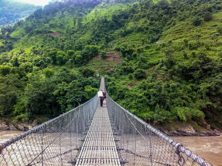
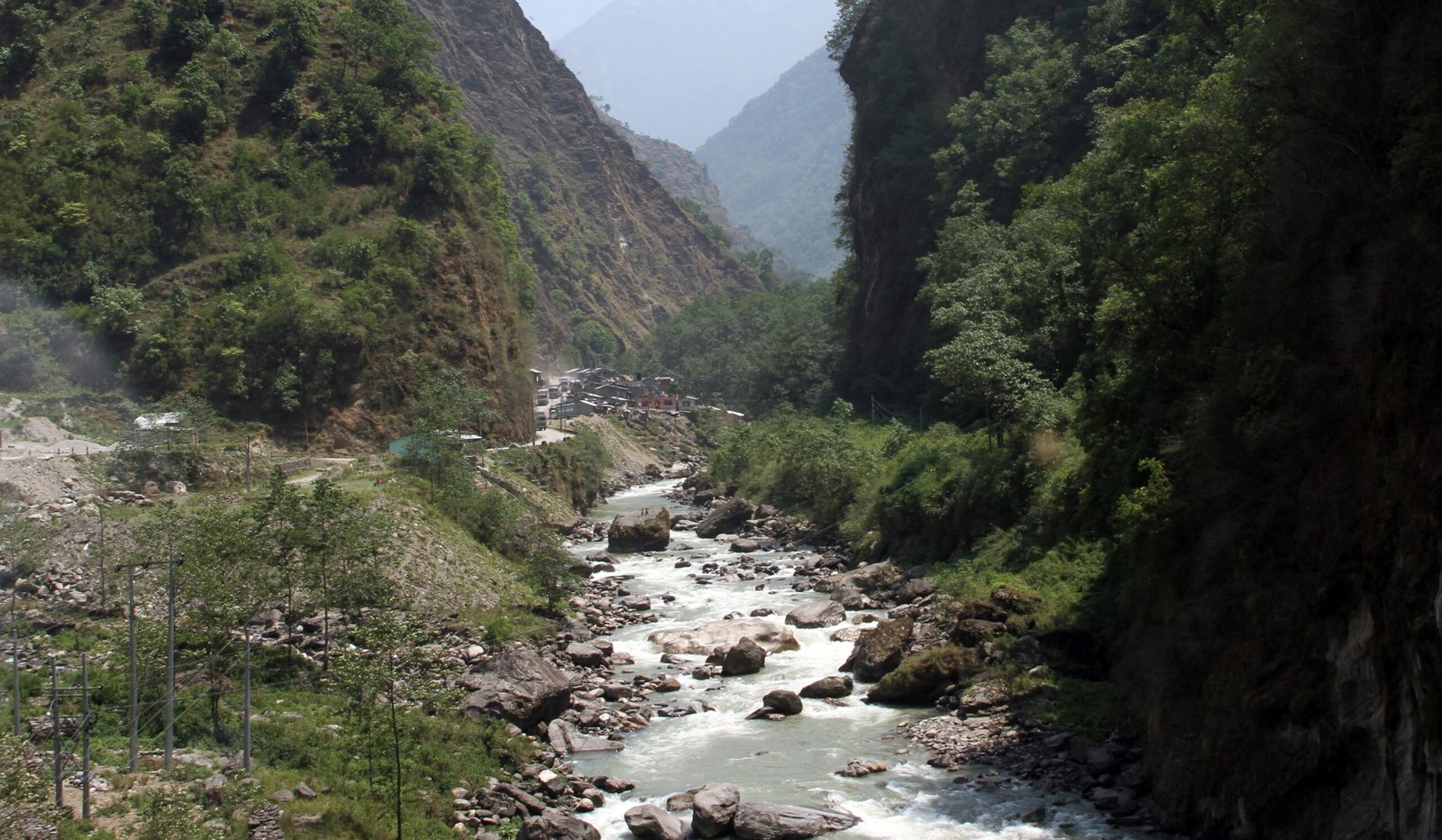
The section of the Araniko Highway from Tatopani and Barabise onwards is widely considered one of the most dangerous highways in Nepal. The road runs alongside the Sun Kosi and Bhote Kosi rivers through extremely steep Himalayan mountainsides that are very prone to landslides during and immediately after rains, including the monsoon season. The topography leaves almost no margin for error — the road is carved into near-vertical slopes with the river far below.
Several factors compound the landslide risk:
- Steep terrain: The mountainsides along the Bhote Kosi gorge are among the steepest in the Nepal Himalaya, with slopes exceeding 60 degrees in many sections.
- Monsoon rainfall: The region receives heavy precipitation from June to September, saturating already unstable slopes.
- Geological fragility: The area sits in a seismically active zone, and the 2015 earthquake further destabilised large sections of the slope.
- Undercutting by rivers: The Bhote Kosi and Sun Kosi rivers erode the base of slopes during high flow, triggering slides above the road.
The Eco section, where the current blockage occurred, has been a chronic trouble spot. The government’s Rs 484.9 million contract to repair just 200 metres of this section underscores how concentrated the damage can be in this terrain. Even when temporary tracks are opened, they remain vulnerable to fresh slides during continued monsoon rainfall.
A History of Closures: From 2014 to 2026
The Araniko Highway has a well-documented history of closures due to landslides, making it one of the most unreliable major highways in Nepal despite its strategic importance:
- 2014 (Sunkoshi Landslides): The highway was closed after a massive landslide at Jure in the Sunkoshi river valley, which killed 156 people and created a natural dam across the Sun Kosi river. The route was shut for 46 days until an alternate route could be built at a cost of Rs 15.5 million.
- 2015 (Earthquake): The April 2015 Gorkha earthquake caused catastrophic damage to the highway, closing the route entirely. It was reopened in early August 2015 after months of repair work, but sustained heavy damage from earthquake-triggered landslides.
- Annual monsoon closures: The section near the Tibet border is especially prone to landslides and experiences partial or complete closures nearly every monsoon season, often lasting days to weeks.
- 2026 (Current blockage): Monsoon landslides blocked the Eco section for approximately one month and the Daklang section for 26 days, with the border crossing remaining only partially operational as of late August 2026.
This recurring pattern of disruption highlights a fundamental challenge: the Araniko Highway was built through terrain that is inherently unsuited for a major road, but its strategic importance as Nepal’s primary overland link to China makes keeping it open a national priority. Each closure brings significant economic costs, particularly for cross-border trade and the supply of goods from China.
Alternative Border Crossings for Travelers
While the Tatopani crossing remains partially closed, travelers and traders have limited alternative options for overland crossing between Nepal and China:
| Border Crossing | Location | Status (Aug 2026) | Notes |
|---|---|---|---|
| Tatopani (Kodari) | Sindhupalchok, Araniko Highway | Partially open | Single-lane traffic at Eco and Daklang; Liping still blocked; ~85 containers stranded on Chinese side |
| Rasuwagadhi (Kerung) | Rasuwa district, northern Nepal | Operational | Alternative route; higher freight costs; connected to Chinese road network via Kerung |
| Korala (Riwu) | Mustang district | Seasonal | High-altitude crossing; subject to weather closures; much longer rerouting from Kathmandu |
For travelers heading to Tibet from Nepal, the Rasuwagadhi crossing in Rasuwa district is currently the most reliable alternative, though it significantly increases travel time and cost compared to the Tatopani route. The Korala crossing in Mustang is seasonal and depends on weather conditions at high altitude. Travelers should check with the Department of Immigration and their tour operators for the latest border crossing status before planning any overland journey to Tibet.
For more comprehensive information on Nepal’s overland entry points, see our guide on how to get to Nepal in 2026, which covers all major border crossings, airports, and overland routes.
Key Takeaways for Travelers
- Partial reopening only: The Eco and Daklang sections of the Araniko Highway are open to single-lane traffic, but the Liping section remains blocked. Full cross-border traffic is not yet operational.
- ~85 containers stranded: Approximately 85 containers remain stuck on the Chinese side due to a landslide there, separate from the Nepal-side blockage.
- Dashain supply concerns: The month-long disruption has delayed imports of goods from China, and traders warn of potential supply shortages ahead of Dashain.
- Chinese contractor delay: China Nineteenth Metallurgical Corporation was supposed to begin repair work in February 2026 but has not started; construction may not begin until late September.
- Tourist activities affected: The Bhote Koshi rafting section, bungee jumping at the Last Resort, and access to Helambu trekking trailheads via the Araniko Highway may be impacted by traffic restrictions.
- Alternatives available: The Rasuwagadhi border crossing in Rasuwa district is operational as an alternative for overland China-Nepal travel, though at higher cost.
- Monsoon travel advisory: The Araniko Highway remains landslide-prone through September. Travelers should check road conditions before departure and avoid the route during heavy rainfall.
FAQ: Tatopani Border Crossing and Araniko Highway
Is the Tatopani border crossing open in August 2026?
As of August 25, 2026, the Tatopani border crossing is only partially operational. The Eco and Daklang sections of the Araniko Highway have been reopened to single-lane traffic, but the Liping section remains blocked due to severe road subsidence. A fresh landslide on the Chinese side of the border also prevents full cross-border movement. Approximately 85 containers remain stranded on the Chinese side. Travelers should not attempt to cross at Tatopani until the Liping section is repaired and the Chinese-side landslide is cleared.
Can tourists use the Araniko Highway right now?
The Araniko Highway is partially open for vehicular traffic, but only in single-lane sections at Daklang and Eco. The road remains in a fragile state and is vulnerable to fresh landslides during continued monsoon rainfall. Tourist activities along the route, including Bhote Koshi rafting and the Last Resort bungee jump, may be accessible from the Kathmandu side up to Barabise, but travel beyond Tatopani toward the border is not recommended until repairs are complete.
What is the alternative to the Tatopani border crossing?
The Rasuwagadhi (Kerung) border crossing in Rasuwa district is the primary alternative for overland travel between Nepal and China. It is currently operational, though it involves a longer route and higher transportation costs compared to Tatopani. The Korala crossing in Mustang district is another option, but it is seasonal and subject to weather-related closures at high altitude. Travelers should verify current border status with the Department of Immigration before planning a crossing.
Why does the Araniko Highway close so frequently?
The Araniko Highway runs through some of the steepest and most geologically unstable terrain in the Nepal Himalaya. From Tatopani and Barabise onwards, the road is carved into near-vertical mountainsides alongside the Bhote Kosi and Sun Kosi rivers. Monsoon rainfall saturates these slopes, triggering landslides that block the road. The 2015 Gorkha earthquake further destabilised the slopes, making landslides more frequent. The route has experienced major closures in 2014, 2015, and now 2026, with smaller disruptions occurring nearly every monsoon season.
When will the Tatopani crossing fully reopen?
The full reopening of the Tatopani border crossing depends on three factors: (1) repair of the Liping section on the Nepal side, which the Road Division Office says will commence shortly; (2) clearing of the landslide on the Chinese side of the border; and (3) the start of construction work by China Nineteenth Metallurgical Corporation, which has indicated it may begin by late September 2026. Traders and officials are pushing for expedited repairs ahead of the Dashain festival, but no definitive timeline for full reopening has been announced.
How does the Tatopani closure affect trekking in Nepal?
The Tatopani closure primarily affects cross-border trade and travelers heading to Tibet via the overland route. For trekkers, the main impact is on access to the Helambu region, which can be reached via a road junction at Lamidanda on the Araniko Highway. Trekkers heading to Helambu should check road conditions before departure and consider alternative access routes via Melamchi Pul Bazaar. The closure does not affect access to major trekking regions like Everest, Annapurna, or Langtang, which use different road networks.
Source: This article is based on reporting by Anish Tiwari for The Kathmandu Post, published August 24, 2026, with additional background information from Wikipedia’s article on the Araniko Highway. Road conditions are as of August 25, 2026, and are subject to change.
Related guide: Nepal Trekking Safety & Health Complete Guide
Related articles:
- How to Get to Nepal 2026: Flights, Airports & Overland Border Crossings
- Nagdhunga Tunnel Opens to Private Vehicles: Nepal’s First Road Tunnel Enters Trial Operation
- Tokha-Chhahare Road Closed at Night: Landslide Risk on Key Nepal-China Border Route
Share this content: