Prithvi Highway Closure September 2026: Traveler Update
Quick answer: Nepal’s main Kathmandu–Pokhara road link is severed. The Prithvi Highway has been fully closed at Krishnabhir in Dhading district since Sunday, 30 August, after about 70 metres of the road collapsed into the Trishuli river — and on Saturday, 5 September, the flood-hit Parewabhir section (Gajuri Municipality–2, Dhading) is additionally shut to all traffic for 12 hours, from 6 am to 6 pm, for repair works ordered by the District Administration Office, Dhading. Officials estimate a temporary bypass track at Krishnabhir could take 10 to 15 days to open (as of 3–4 September — an estimate, not a promise). Through traffic is being diverted via the Hetauda–Naubise and Fisling–Benighat routes, and Kathmandu–Pokhara flights are the fastest alternative for travelers right now.

- Krishnabhir section (Dhading): fully closed since 30 August — about 70 m of road collapsed into the Trishuli river; another 120 m has severe cracks (confirmed by police and road officials).
- Parewabhir section (Gajuri–2, Dhading): complete 12-hour vehicle closure on Saturday 5 September, 6 am–6 pm; only ambulances and hearses excepted.
- Reopen estimate: a temporary track above the collapsed Krishnabhir section may take 10–15 days (official estimate, as of 3 September).
- Official diversions: Hetauda–Naubise and Fisling–Benighat routes.
- About 12,000 vehicles normally use the affected section every day.
- Kathmandu–Pokhara flights bypass the road closure entirely.
What exactly is closed on the Prithvi Highway?
Two separate sections of the highway’s Dhading stretch are affected, and travelers should not confuse the two.
1. Krishnabhir — full severance since 30 August (CONFIRMED). About 70 metres of the two-lane highway collapsed into the Trishuli river after devastating flooding on 26 August, and another 120 metres of pavement has developed severe cracks, according to The Kathmandu Post. The section — part of the busy Malekhu–Mugling corridor — has now been closed for the better part of a week, disrupting supplies and travel to and from the national capital. The Department of Roads says around 12,000 vehicles normally use this highway section on a daily basis.
2. Parewabhir — 12-hour full closure on Saturday 5 September (CONFIRMED). The District Administration Office, Dhading has ordered the Parewabhir road section at Gajuri Municipality–2 completely closed to vehicular traffic from 6 am to 6 pm on Saturday for repair of the flood-damaged road. During the closure window, all vehicles except essential ones — ambulances and hearses — are barred from the section. The administration has publicly apologised for the inconvenience to passengers and drivers and asked everyone to use alternative routes during the period. The Parewabhir stretch had already been operating one-way only since the Bhotekoshi river flood of 26 August damaged it.
Police say the damage is not confined to these two points. Senior Superintendent of Police Ramesh Thapa, deployed to the Prithvi Highway area from Police Headquarters, told The Kathmandu Post that three locations along the Naubise–Mugling stretch have suffered major damage, that about 700 metres of highway near Nagdhunga towards Naubise has subsided, and that the road has also been washed away around Parewatar and Shital Bazar in the Malekhu area, with landslides and erosion continuing to cause damage at several points.
| Section | Status (as of 5 Sept 2026) | Since | Expected duration |
|---|---|---|---|
| Krishnabhir (Malekhu–Mugling corridor, Dhading) | Fully closed — ~70 m collapsed into the Trishuli, ~120 m cracked | 30 August | Temporary track estimated in 10–15 days (EXPECTED) |
| Parewabhir (Gajuri–2, Dhading) | Fully closed 6 am–6 pm on 5 September for repairs; one-way before that | 26 August (one-way); full closure 5 Sept | Single-day closure (CONFIRMED) |
| Nagdhunga–Naubise area | ~700 m subsided; crews monitoring multiple damage points | After 26 August flood | Ongoing repairs |
Why did the Prithvi Highway collapse?
The immediate trigger was the catastrophic Bhotekoshi river flood of 26 August 2026 — the same disaster that devastated the Rasuwa–Bhotekoshi corridor upstream (see our flood rescue update). Floodwaters laden with gravel slammed the base of the Krishnabhir slope, and within days a 70-metre slab of the highway above slid into the Trishuli river. Engineers quoted in The Kathmandu Post say the slope is so fragile — its base steadily eaten away by the river — that repairs from the riverbank would be extremely difficult while the monsoon continues.
Krishnabhir’s instability is anything but new. A major slide in 2000 blocked the highway for 11 days; authorities responded with bioengineering and support-wall works in 2007. The problem kept returning — the Department of Roads reported last year that water had caused parts of the road to sag and sink, and engineers had been attempting to stabilise the hillside with micro-piling, horizontal anchors and improved drainage. The collapsed section sat on a fragile hillside whose base the Trishuli has been undercutting for years.
Some background for first-time visitors: the Prithvi Highway (NH17) is a 174-kilometre road built between 1967 and 1974 with Chinese government assistance, named after King Prithvi Narayan Shah. It links Naubise — 26 km from Kathmandu on the Tribhuvan Highway — with Prithvi Chowk in Pokhara, passing through five districts: Kathmandu, Dhading, Chitwan, Tanahu and Kaski. Until the B.P. Koirala Highway opened in 2011, it was the only improved land route from the Kathmandu Valley to points south, and it remains the trunk route for supplies and Pokhara-bound travelers. Its hazard record is long: floods in 1993 washed out three major bridges near Mahadevbesi, Belkhu and Malekhu. This is also the second Prithvi Highway closure in quick succession — an earlier landslide at a different point in Tanahun blocked traffic in August (see our earlier Prithvi Highway report), and the highway was among seven road sections blocked countrywide after the floods.
When will the Prithvi Highway reopen? (EXPECTED — not confirmed)
Officials have chosen to build an entirely new track above the collapsed section rather than rebuild on the failed slope. Sajana Adhikari, chief of the Malekhu–Muglin Road Project, inspected the site and told The Kathmandu Post: “We have started work. It may take 10 to 15 days… We will excavate the hillside above the collapsed section and connect the new track to the Prithvi Highway.” As of 4 September, about 50 metres of the temporary track had been cut and excavators were working from both ends of the landslide site — though the initial track is only wide enough for the excavators themselves.
The Ministry of Physical Infrastructure and Transport has approved both immediate and long-term measures. Under the immediate plan, structures will be built above the gabion breast wall on the hillside so vehicles can use the route, with “sacrificial gabion boxes” installed and boulders dropped from the hillside to stabilise the area. For a lasting fix, the ministry has asked the Department of Roads to study a tunnel, soil nailing, sheet piling or a bypass road, with an alternative road arrangement targeted by the end of the current fiscal year and expert services provided by the Nepal Geotechnical Society. Infrastructure Development Minister Sunil Lamsal confirmed the two-track approach on social media.
Translation for travelers: treat 10–15 days as a working estimate, not a commitment. Engineers themselves caution that the scale and cause of the damage must be established before a permanent design is chosen, and a technical assessment was still under way as of the latest reports. Monsoon rainfall remains an active risk to any open track.
What are the alternative routes from Kathmandu to Pokhara?
With the road severed at Krishnabhir, vehicles traveling to and from Kathmandu have been using alternative highways. Officials have diverted traffic to routes linking Hetauda–Naubise (entering the Kathmandu Valley from the south via the Tribhuvan Highway corridor) and Fisling–Benighat (running along the opposite bank of the Trishuli). The Department of Roads is examining roads on both sides of the Trishuli as alternative routes, and Director General Bijaya Jaisi said several options were being considered.
| Option | Status (as of 5 Sept 2026) | Notes for travelers |
|---|---|---|
| Prithvi Highway via Mugling | Closed at Krishnabhir; Parewabhir also closed 6 am–6 pm on 5 Sept | Do not plan on this road until reopening is officially confirmed |
| Diversion via Hetauda–Naubise | Open (official diversion) | Longer southern route; expect heavier-than-normal traffic |
| Diversion via Fisling–Benighat | Open (official diversion) | Opposite-bank Trishuli route; conditions being assessed by DoR |
| Kathmandu–Pokhara flight | Operating | Fastest option; the short flight fully bypasses the road closure |
Two practical notes. First, the diversion routes are absorbing much of the displaced traffic, so even “open” roads are slower than usual — build buffer time into any overland itinerary this month. Second, the subsidence near Nagdhunga is a reminder that this corridor has multiple weak points; the brand-new Nagdhunga tunnel now gives drivers a bypass of one of the highway’s older hazard sections, but flood damage on the open stretches remains the controlling factor.
What does this mean for Annapurna trekkers and the autumn season?
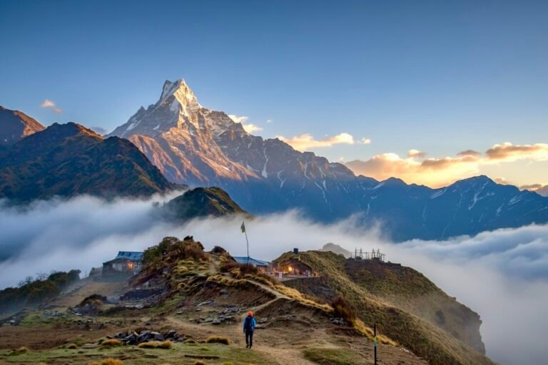
The timing is awkward: the closure lands right at the start of Nepal’s autumn trekking season, the mid-September-to-November window when thousands of walkers head west from Kathmandu toward Pokhara, the gateway to the Annapurna region (our autumn climbing season guide covers the parallel rush on the mountaineering side). The good news for trekkers: once you are in Pokhara, the highway closure does not affect trail access — the standard Annapurna trailheads are reached from Pokhara itself on short local drives.
The pinch point is simply getting to Pokhara. Trekkers with fixed itineraries should either fly Kathmandu–Pokhara or budget generous extra hours for the diversion roads. If your itinerary has no slack, consider arriving a day early. Travelers who prefer to hand road logistics, permits and fixed departures to an operator can look at organised Nepal tours and treks, which re-plan around closures like this one as a matter of course.
Knock-on effects: fuel and supplies in Kathmandu
The closure is not just a travel inconvenience — it is squeezing supplies into the capital. The Kathmandu Valley normally consumes 35,000 to 40,000 LPG cooking-gas cylinders a day, and the disruption of the Prithvi Highway and other major roads linking the capital with the Tarai has severely affected distribution, the state-owned Nepal Oil Corporation says. NOC deputy director Manoj Kumar Thakur: “Demand is huge and we can supply it, but the condition of the roads has hampered distribution.” The corporation supplied 24,500 cylinders in the valley in a single day late last week and says it is prioritising people affected by the 26 August disaster.
For visitors, the practical fallout is in restaurants and guesthouses. The Restaurant and Bar Association Nepal says a restaurant typically needs five to six LPG cylinders a day during the tourist season, and its president, Sangharsha Bista, warned that if supply does not improve by the coming week, some businesses would have no option but to shut down. NOC has denied rumours of a formal bar on commercial LPG supply — hotels and restaurants can still obtain gas — but expect the possibility of reduced menus or slower kitchen service in some Kathmandu eateries until the highway reopens.
Practical checklist for travelers
- Traveling today (Saturday 5 September): keep off the Prithvi Highway entirely until after 6 pm — the Parewabhir closure admits only ambulances and hearses.
- Reconfirm with your bus or transport operator the night before travel. Most long-haul vehicles are using the Hetauda–Naubise or Fisling–Benighat diversions, and departure points or timings may have shifted.
- On a tight schedule? Fly Kathmandu–Pokhara instead of driving; the flight completely sidesteps the closure.
- Build in buffer time. Diversion routes are carrying displaced traffic and are slower than the direct highway — add generous margins to connection-heavy itineraries.
- Annapurna trekkers: trailheads from Pokhara are unaffected; the only bottleneck is reaching Pokhara. Arrive a day early if your trek starts on a fixed date.
- Follow official reopen announcements, not social-media rumours — the 10–15 day track estimate at Krishnabhir is an engineering estimate that monsoon weather could extend.
FAQ
Is the Prithvi Highway closed today?
Yes. As of Saturday 5 September 2026, the Krishnabhir section has been fully closed since 30 August after about 70 metres of road collapsed into the Trishuli river, and the Parewabhir section is completely closed to vehicles from 6 am to 6 pm on 5 September for flood-repair works. Only ambulances and hearses are allowed through during the Parewabhir window.
Can I still travel from Kathmandu to Pokhara by road?
Yes, but not on the direct highway. Officials have diverted traffic via routes linking Hetauda–Naubise and Fisling–Benighat. These alternatives are open but longer and busier than usual, so overland journeys take significantly more time than in normal conditions.
How long will the Prithvi Highway stay closed?
The confirmed closure is indefinite pending official announcement. The Department of Roads’ working estimate, as of 3 September, is that a temporary track above the collapsed Krishnabhir section could open in 10 to 15 days. A permanent solution — possibly a tunnel, bypass, soil nailing or sheet piling — is still being studied.
Are Kathmandu–Pokhara flights affected by the road closure?
No. The road closure does not affect domestic flights. The short Kathmandu–Pokhara flight is currently the fastest and most reliable way to reach the Annapurna region’s gateway.
Should I cancel my Annapurna trek because of the closure?
No. The trails themselves are unaffected — Annapurna trailheads are reached from Pokhara on short local roads. Adjust only your transport to Pokhara: fly, or allow extra hours on the diversion routes.
Why does Krishnabhir keep collapsing?
The slope sits above a river bend where the Trishuli has long undercut the hillside’s base. A major slide blocked the highway for 11 days in 2000; bioengineering and support walls followed in 2007; and engineers had already been fighting sagging road surfaces with micro-piling and anchors. The 26 August flood delivered the blow the weakened slope could not absorb.
Sources
- Online Khabar (Nepali language), “Prithvi Rajmarg ko Parewabhir khand 12 ghanta purn band, baikalpik marg prayog garne agrah” (“Parewabhir section of Prithvi Highway completely closed for 12 hours, appeal to use alternative routes”), 5 September 2026 — onlinekhabar.com (District Administration Office Dhading closure order; 6 am–6 pm window; ambulance/hearse exception).
- The Kathmandu Post, “New bypass track to be built above collapsed stretch of Prithvi Highway”, 3 September 2026 — kathmandupost.com (70 m collapse, 120 m cracks, 12,000 vehicles/day, 10–15 day estimate, diversion routes, damage history).
- The Kathmandu Post, “Road department begins cutting new track to reopen flood-hit Prithvi Highway”, 4 September 2026 — kathmandupost.com (50 m of track cut, excavators at both ends, ministry measures).
- The Kathmandu Post, “Krishnabhir collapse disrupts LPG supply to Kathmandu”, 3 September 2026 — kathmandupost.com (cylinder demand and restaurant-sector figures).
- Background facts on the highway’s route, length, construction history and 1993 bridge washouts: Wikipedia, “Prithvi Highway”, accessed 5 September 2026.
Published 5 September 2026. Road status is changing daily in the flood aftermath — confirm with your transport operator or the District Administration Office before traveling. Figures in this article are confirmed as reported by the outlets above; reopen timelines are official estimates and are labelled as expected, not guaranteed.
Share this content: