Prithvi Highway Closure at Krishnabhir: 2026 Travel Update
Update, 14 September 2026: The first vehicles have now crossed the restored track at Krishnabhir in a supervised trial run, and the Department of Roads expects two-way traffic from Thursday 17 September. Read the latest status in Krishnabhir Trial Run: First Vehicles Cross the Prithvi Highway.
Route alert: Since this article was published, the Tribhuvan Highway itself has been blocked by a landslide at Salyangkhola, Dhading (10 September 2026). Read the current route situation: Tribhuvan Highway Blocked After Salyangkhola Landslide.
Update, 7 September 2026: With the highway still broken at Krishna Bhir, Buddha Air has more than doubled Bharatpur-Kathmandu flights to up to 11 a day. See our latest report on Bharatpur-Kathmandu flights doubling after the road closure.
Update, 7 September: While the Krishnabhir repair continues, the Chitwan administration has now partially closed the Narayangadh-Mugling road section in five daily windows for landslide-prevention works at Tuin Khola, tied to this repair timeline.
Quick answer (as of Saturday, 5 September 2026): The Prithvi Highway — Nepal’s main road linking Kathmandu with Pokhara and the country’s western districts — is cut at Krishnabhir in Dhading district, where about 70 metres of road collapsed into the Trishuli river during the late-August flood disaster. The Department of Roads is cutting a temporary track above the collapsed section, and officials aim to restore vehicle traffic within roughly 10–15 days (an estimate, not a guarantee). On Saturday 5 September, the nearby Parewabhir section was additionally closed completely from 6 am to 6 pm for repairs. Travellers should fly between Kathmandu and Pokhara, expect long detours on buses, or delay road journeys until the highway reopens.
Key Takeaways
- CONFIRMED: About 70 metres of the Prithvi Highway fell into the Trishuli river at Krishnabhir, and another 120 metres has developed severe cracks (Kathmandu Post, 3 September).
- CONFIRMED: The section has been closed since about Sunday 30 August; around 12,000 vehicles normally use it daily (Department of Roads).
- CONFIRMED: On Saturday 5 September, the Parewabhir section (Gajuri, Dhading) was fully closed 06:00–18:00 for repair work — only ambulances and hearses exempted (District Administration Office, Dhading).
- EXPECTED: Officials estimate 10–15 days to cut a temporary track above the collapse and reopen traffic — i.e. around mid-September, if all goes to plan.
- Traveller options: Fly Kathmandu–Pokhara (about 25 minutes), take a diverted bus via the Hetauda corridor (much longer), or postpone road travel.
Table of Contents
- What Happened at Krishnabhir?
- Saturday’s Full-Day Closure at Parewabhir
- The Repair Plan: A New Track Above the Collapse
- Why the Prithvi Highway Matters for Nepal Travel
- Wider Flood Damage on the Kathmandu–Mugling Corridor
- The Bigger Picture: The Bhotekoshi–Trishuli Flood
- What It Means for Travellers Heading to Pokhara
- Alternative Routes and Traffic Rules in Force
- Frequently Asked Questions
- Sources
What Happened at Krishnabhir?
The crisis on Nepal’s most important tourist road began in the final days of August 2026. After devastating flooding on the Trishuli river system, roughly 70 metres of the Prithvi Highway at Krishnabhir — a notoriously unstable slope in Dhading district, about 80 km west of Kathmandu — collapsed into the river below. A further 120 metres of the road surface has developed severe cracks, according to the Kathmandu Post (3 September). As of Thursday 3 September, the highway had already been closed for five days, disrupting supplies and travel to and from the capital.
Why did the road fail? Naresh Man Shakya, a former joint secretary at the infrastructure ministry, said a technical team was still assessing the site: “It is not yet clear how serious the damage is or how it can be repaired. It appears that the road collapsed after powerful floodwaters laden with water and gravel slammed the Krishnabhir base.” In other words, the flood did not simply wash debris across the road — it scoured away the slope beneath it. That is why engineers say repairing the original alignment from the riverbank would be extremely difficult during the monsoon, and why the Department of Roads has opted to build above the collapse instead.
Saturday’s Full-Day Closure at Parewabhir
Even as the bypass works continue at Krishnabhir, another damaged section of the same highway is getting emergency repairs. The Parewabhir stretch in Gajuri Rural Municipality-2, Dhading, has been operating one-way only since flood damage on 10 Bhadau (late August). On Saturday 5 September, the District Administration Office Dhading ordered the section completely closed from 6 am to 6 pm so repair work could proceed.
Per the administration’s public notice, every vehicle except essential services — ambulances and hearses — is barred from the section during the closure window. The administration apologised for the inconvenience and asked all travellers and drivers to use alternative routes during this period. If you are on the road today, treat any Kathmandu–Mugling–Pokhara itinerary as severely disrupted.
The Repair Plan: A New Track Above the Collapse
Immediate works
The Department of Roads has begun cutting an entirely new track into the hillside directly above the collapsed section at Krishnabhir. Sajana Adhikari, chief of the Malekhu–Mugling Road Project, inspected the site and told reporters: “We have started work. It may take 10 to 15 days. We are currently clearing trees. We will excavate the hillside above the collapsed section and connect the new track to the Prithvi Highway.”
By Friday 4 September, excavators were working from both ends of the landslide site and about 50 metres of temporary track had been opened — wide enough, so far, only for the excavators themselves. Under the immediate plan approved by the Ministry of Physical Infrastructure and Transport, engineers will build structures above a gabion breast wall on the hillside so vehicles can use the new route, install “sacrificial” gabion boxes, and drop loose boulders from the hillside to stabilise the slope.
Long-term options
A temporary track will get traffic moving, but everyone agrees Krishnabhir needs a permanent fix. The ministry has asked the Department of Roads to study a tunnel, soil nailing, sheet piling, or a bypass road, with an alternative road arrangement targeted by the end of the current fiscal year. The Nepal Geotechnical Society will provide expert services. Infrastructure Development Minister Sunil Lamsal said the immediate and long-term measures had been approved, while Department of Roads Director General Bijaya Jaisi said officials were “working to find a way to operate the road by making arrangements on both sides of Krishnabhir.”
Status label: EXPECTED. The 10–15 day reopening timeline is an official estimate from the road project chief, quoted on 3 September — meaning traffic could resume around mid-September if the hillside cooperates. Landslide-prone slopes in monsoon conditions have a habit of disagreeing with engineering schedules, so build flexibility into your plans.
Why the Prithvi Highway Matters for Nepal Travel

For visitors, the Prithvi Highway is simply “the road to Pokhara” — the 174 km (108 mi) national highway (NH17, formerly H04) that runs from Naubise, 26 km west of Kathmandu, to Prithvi Chowk in Pokhara. Built with Chinese assistance between 1967 and 1974 and named after King Prithvi Narayan Shah, it passes through five districts — Kathmandu, Dhading, Chitwan, Tanahu and Kaski — and carries most overland travellers toward the Annapurna region, the Manakamana temple cable car near Mugling, and the Gorkha turnoff. On clear days the road serves dramatic views of Machhapuchhre and the Annapurna massif.
The highway is also the supply artery of the capital. Food, vegetables, milk, medicines, cooking gas and fuel normally enter Kathmandu through this corridor, and the Department of Roads says around 12,000 vehicles use the affected section daily. Until the 2011 opening of the B.P. Koirala Highway, it was the only improved land route from the Kathmandu Valley to the south and west.
Krishnabhir itself has a long, documented record of instability. A major landslide in 2000 blocked the highway for 11 days; authorities carried out bioengineering and support-wall works in 2007, but the problem kept returning. The Department of Roads reported in 2025 that water had caused the road to sag and sink, and engineers had been trying to stabilise the slope with micro-piling, horizontal anchors and improved drainage even before this collapse. The highway also has flood history: in 1993, floods washed out three major bridges on the road, near Mahadevbesi, Belkhu and Malekhu.
Wider Flood Damage on the Kathmandu–Mugling Corridor
The damage is not confined to a single point. Senior Superintendent of Police Ramesh Thapa, deployed to the Prithvi Highway area from Police Headquarters, said three locations along the Naubise–Mugling section suffered major damage in the floods: “The road at Krishnabhir is completely closed. The road has also been washed away around Parewatar and Shital Bazar in the Malekhu area. Landslides and erosion continue to cause damage at several other places.” A separate stretch of about 700 metres towards Naubise from Nagdhunga — the valley’s western gateway, where the new Nagdhunga tunnel opened to private vehicles last month — has also subsided.
This event did not come out of nowhere: heavy monsoon rains had already blocked multiple road sections across Nepal in late August, and a landslide on the Prithvi Highway in Tanahun had snarled traffic earlier the same month. The late-August Bhotekoshi flood simply delivered the knockout blow to a corridor that was already fragile.
The Bigger Picture: The Bhotekoshi–Trishuli Flood
The Krishnabhir collapse is one consequence of the catastrophic Bhotekoshi river flood of 26 August 2026, which began upstream in the Rasuwa–Sindhupalchok border area and sent a flood wave down through the Trishuli river system — the same river that runs beneath the Prithvi Highway at Krishnabhir. We covered the rescue operation and the missing-persons crisis in our earlier report on the Rasuwa–Bhotekoshi flood. By 5 September, Nepal Police figures reported by the Kathmandu Post and Online Khabar put the nationwide flood death toll above 1,340, with roughly 4,900 people still unaccounted for — the deadliest disaster Nepal has seen in years. On the Chinese side of the border at Kerung, Online Khabar reported 31 dead and 531 missing.
For the tourism economy, the timing is bitter. September marks the start of Nepal’s autumn climbing and trekking season — the busiest window of the year for expeditions, with 367 climbing permits already issued this season. Pokhara is the gateway city for the Annapurna circuit, Annapurna Base Camp, Mardi Himal and Poon Hill treks, and nearly all of those journeys begin with the Kathmandu–Pokhara transfer that this highway carries.
What It Means for Travellers Heading to Pokhara
Here is the practical situation for travellers as of Saturday 5 September 2026:
| Option | Realistic Time | What to Know |
|---|---|---|
| Fly Kathmandu–Pokhara | ~25–30 minutes | The fastest, most reliable option while the highway is cut. Domestic carriers operate the route; demand will be heavy in peak season — book ahead. |
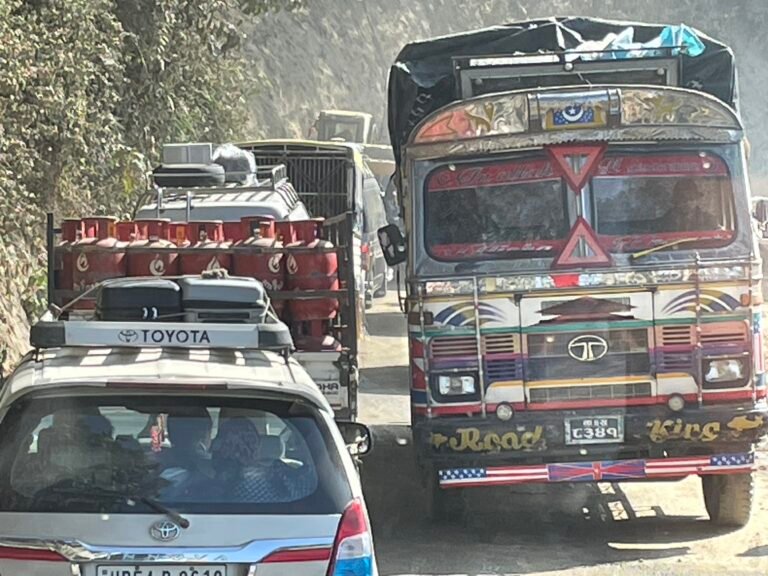
| Diverted bus / private vehicle | Several hours longer than usual | Traffic runs via the Hetauda corridor (Tribhuvan Highway / Kanti Lokpath) and the Fisling–Benighat link. Expect congestion, narrow winding roads and monsoon landslide risk. |
| Postpone road travel | Wait for reopening | Officials expect a temporary track above Krishnabhir to open in 10–15 days from 3 September (around mid-September) — an estimate, not a promise. |
Travellers with Annapurna-region itineraries should read our complete guide to Annapurna region treks for route and permit planning, and our overview of how to get to and around Nepal for transport fundamentals. If your trek starts from Pokhara or Besi Sahahar within the next two weeks, flying is almost certainly the right call; the diverted road routes add hours and pass through flood-affected districts where landslide activity continues.
Also note the knock-on effects: because Kathmandu’s supplies normally arrive by this highway, long-haul tourist buses from the capital toward Chitwan, Lumbini and points west are all running on diversion corridors too. If you have a booked itinerary that includes road sectors in central Nepal this month, confirm with your operator the morning you travel.
Alternative Routes and Traffic Rules in Force
With the road severed at Krishnabhir, the Department of Roads has diverted traffic onto routes linking Hetauda–Naubise and Fisling–Benighat. Authorities have also divided Kathmandu–Hetauda traffic to keep the alternative roads within their capacity, as reported by the Kathmandu Post:
- Vehicles with fewer than 14 seats, travelling from Hetauda towards Kathmandu, are sent via the Bhimphedi–Kulekhani–Sisneri–Dakshinkali route.
- Vehicles travelling from Kathmandu to Hetauda use the Pharping–Phakhel–Kulekhani–Bhimphedi route.
- Large passenger buses and freight vehicles heading to Kathmandu are directed through the Tribhuvan Highway.
- Smaller passenger buses and empty vehicles returning to Hetauda use the Kanti Lokpath.
- The Tribhuvan Highway is narrow and winding, so vehicles with more than ten wheels are barred from it.
For independent travellers: tourist buses and private transfers will follow whichever corridor their operator is assigned — you do not choose the route yourself. Budget extra hours, carry water and snacks, avoid night driving on the diversion roads, and re-check conditions the day before departure. Our guide to trekking safety and health in Nepal covers the wider precautions for monsoon-shoulder-season travel.
Frequently Asked Questions
Is the Prithvi Highway open today (5 September 2026)?
No. The Krishnabhir section near Malekhu is completely closed after about 70 metres of road collapsed into the Trishuli river, and the Parewabhir section in Gajuri, Dhading was fully closed from 6 am to 6 pm on Saturday 5 September for repairs. Only ambulances and hearses are exempted from the Parewabhir closure.
How long will the Prithvi Highway be closed?
Officials quoted on 3 September estimate 10 to 15 days to cut a temporary track above the collapsed section and restore vehicle traffic — pointing to a reopening around mid-September. This is an EXPECTED timeline, not a confirmed reopening date; the slope remains landslide-prone and works are monsoon-dependent. Long-term fixes (a tunnel, soil nailing, sheet piling or a bypass) will take far longer.
Can I still get from Kathmandu to Pokhara?
Yes. Flying takes about 25–30 minutes and is the practical option while the highway is cut. Buses and private vehicles continue to run via diversion corridors (the Hetauda side and the Fisling–Benighat link), but journeys are several hours longer than the normal 6–7 hour drive and subject to congestion and further monsoon disruption.
What caused the Krishnabhir collapse?
A technical assessment is still under way, but the current finding, as a former infrastructure ministry joint secretary told the Kathmandu Post, is that powerful floodwaters laden with water and gravel slammed the base of the Krishnabhir slope, undermining the road above. The site has a documented history: a 2000 landslide blocked the highway for 11 days, and stabilisation works since 2007 have repeatedly needed repair.
Are Chitwan, Lumbini and other destinations affected too?
The closure affects the main Kathmandu–west corridor, so all road traffic between the capital and points west — including toward Chitwan, Lumbini and Pokhara — is diverted, adding travel time. The destinations themselves remain open and reachable; it is the road access from Kathmandu that is disrupted.
Where can I monitor updates?
Follow Department of Roads statements (including its official social media updates), District Administration Office Dhading notices for Parewabhir closure schedules, and daily coverage in the Kathmandu Post and Online Khabar. We will update this article as the reopening timeline firms up.
Sources
- Kathmandu Post — “New bypass track to be built above collapsed Krishnabhir stretch” (3 September 2026): kathmandupost.com
- Kathmandu Post — “Road department begins cutting new track to reopen flood-hit Prithvi Highway” (4 September 2026): kathmandupost.com
- Online Khabar (Nepali language) — “Prithvi Rajmarg’s Parewabhir section fully closed for 12 hours, appeal to use alternative routes” (5 September 2026): onlinekhabar.com
- Wikipedia — “Prithvi Highway” (background: route, history, districts; accessed 5 September 2026): en.wikipedia.org
- TravellingNepal.com — Rasuwa–Bhotekoshi flood rescue update and Autumn climbing season 2026.
Related Guides
- Annapurna Region Treks: Complete Guide — planning treks from the Pokhara gateway
- Nepal Trekking Safety and Health: Complete Guide — monsoon-season travel precautions
- Prithvi Highway landslide, Tanahun (August 2026) — earlier disruption on the same road
- Seven road sections blocked across Nepal (August 2026) — the wider monsoon road picture
- How to Get to Nepal 2026: Flights, Airports and Overland Routes
- Nagdhunga tunnel opens to private vehicles — context for the Nagdhunga area mentioned above
Published: 5 September 2026. This article will be updated as the repair works at Krishnabhir and Parewabhir progress. All status labels — CONFIRMED and EXPECTED — reflect sourcing as of the publication date.
Share this content: