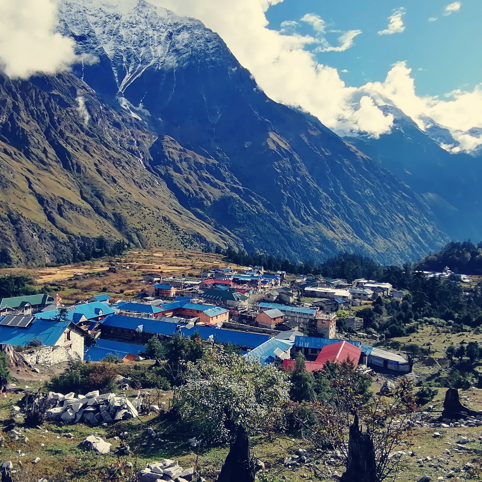
Namrung Flash Flood Hits Manaslu Circuit Trek Corridor
Update, September 6, 2026: The District Administration Office Gorkha has now formally asked trekkers not to travel on the Manaslu and Larke Pass trail until further notice. Read the full Manaslu and Larke Pass trail suspension notice.
Breaking news, Sunday 6 September 2026 (Kathmandu): A flash flood on the Namrung Khola in Chumnubri Rural Municipality-4 of Gorkha district struck at around 3 am on Sunday morning, washing away four houses and the iron bridge that linked ward 4 with ward 2. No human casualties have been reported: Gorkha District Police confirmed that villagers ran to safety as soon as they heard the flood coming. By 4:40 am the flood pulse had passed and the river had returned close to its normal level, according to local officials.
The location matters for trekkers. Namrung sits squarely on the Manaslu Circuit, the 177 km trek around the world’s eighth-highest mountain, and the flood arrived days before the main autumn trekking wave, with 348 climbers already holding Manaslu permits for this season. Here is what is confirmed so far, what remains unknown, and what it means for anyone heading to the Manaslu region this autumn.
Key Takeaways
- What happened: A flash flood on the Namrung Khola, Chumnubri Rural Municipality-4, Gorkha, at around 3 am on Sunday 6 September 2026 washed away four houses and a ward footbridge.
- Casualties: None reported. Locals evacuated themselves in time, according to Gorkha’s Deputy Superintendent of Police.
- River status: Flood flow decreased from about 4:40 am Sunday; the river was back near its normal state by morning.
- Trek impact: No official trail closure had been announced as of Sunday morning. Treat trail conditions as unconfirmed until district authorities, the Manaslu Conservation Area office or trekking agencies issue statements.
- Downstream warning: The Namrung Khola joins the Budhi Gandaki; riverside residents downstream have been urged to stay alert.
- Season context: 29 teams with 348 climbers hold autumn 2026 Manaslu permits, the Department of Tourism reports.
Table of Contents
- What Happened on the Namrung Khola
- Where Is Namrung and Why Trekkers Know It
- Was Anyone Hurt or Evacuated?
- Is the Manaslu Circuit Trek Affected?
- A Week of Flash Floods Across Nepal’s Trekking Districts
- Autumn Season Stakes: 348 Climbing Permits and Counting
- What Trekkers Should Do Now
- Frequently Asked Questions
- Sources
- Related Guides

What Happened on the Namrung Khola
According to Online Khabar, which reported the event in two separate dispatches on Sunday morning (both in Nepali), the flood came down the Namrung Khola at around 3 am on Sunday, 6 September 2026 (21 Bhadra in the Nepali calendar). The worst damage was concentrated in ward 4 of Chumnubri Rural Municipality, the administrative unit that covers the upper Budhi Gandaki valley, better known to trekkers as the Manaslu region.
What is confirmed (as of Sunday morning, 6 September):
- Four houses were swept away in Namrung, ward 4. The households identified in the police report are those of Nurbu Ongyal, Urgen Chyoden, Lakpa Bhuti and Dorje Gyaljen (names transliterated from the Nepali-language report).
- An iron bridge connecting ward 4 and ward 2 of the rural municipality was washed out.
- No loss of life or injuries has been reported. DSP Rajkumar Shrestha of Gorkha district police told Online Khabar that villagers who heard the flood approaching fled in time and saved their lives.
- The flood’s flow decreased from about 4:40 am on Sunday, and the river has since returned close to its previous level.
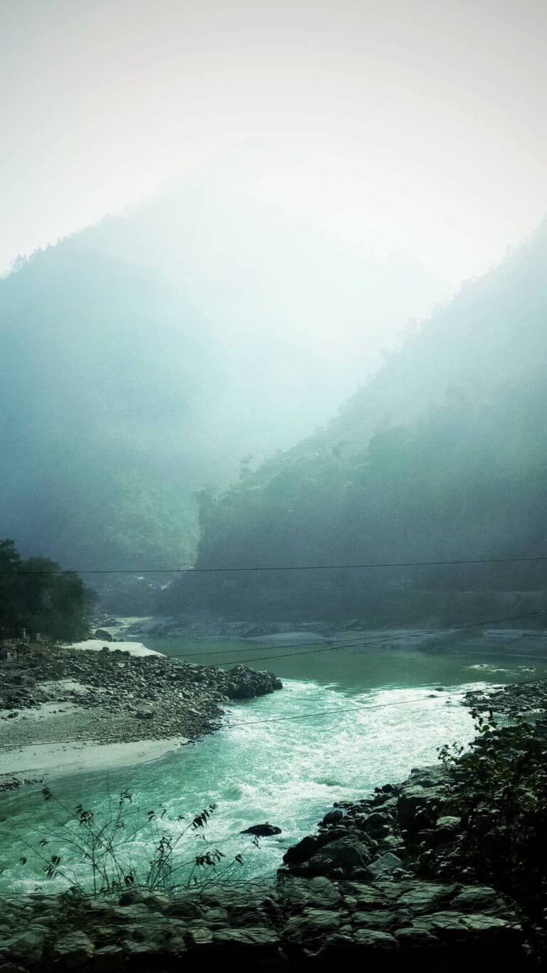
- Netra Prasad Sharma, assistant chief district officer, gave a preliminary explanation: the river may have been briefly dammed somewhere upstream, and when the blockage gave way, the water came down all at once, thick with sediment and debris.
- Because the Namrung Khola merges with the Budhi Gandaki, authorities have asked residents along the Budhi Gandaki’s banks to remain alert.
What is not yet known: The full extent of trail and infrastructure damage beyond the four houses and the bridge, the timeline for rebuilding the ward bridge, and whether any section of the trekking route itself has been affected. As of Sunday morning no official statement on trail closures had been issued. Nothing in this report should be read as confirmation that the circuit is closed, or open.
Where Is Namrung and Why Trekkers Know It
Namrung is a familiar name to anyone who has walked the Manaslu Circuit. The standard itinerary, described in our complete Manaslu Circuit trek guide, runs from Kathmandu by road to Machha Khola, roughly a seven to eight hour drive, then up the Budhi Gandaki valley through Jagat, Deng, Namrung and Samagaon at about 3,530 m, before crossing the Larkya La pass, around 5,106 m by most references, to Bhimtang and out at Dharapani on the Annapurna side. Namrung is the village where the trail pivots from the deep, gorge-flanked lower valley into the higher, wider country of Tibetan-influenced Nubri. Trekkers typically spend an acclimatization night here as the trail climbs toward Samagaon and Larkya La.
Manaslu itself, at 8,163 m the eighth-highest mountain on earth, rises at the head of this valley system in the Mansiri Himal of Gorkha district. The circuit that skirts the massif follows an ancient salt-trading route up the Budhi Gandaki and was only opened to organized trekking in 1991, according to Wikipedia’s referenced profile of the mountain. The whole valley now falls inside the Manaslu Conservation Area, a 1,663 square kilometre protected zone established in 1998 that ranges from 1,400 m river valleys to the summit itself.
In other words: this was not a flood in some distant corner of Nepal. It struck a village that nearly every Manaslu Circuit trekker walks through, on the main approach to one of the busiest restricted-area treks of the autumn calendar.
Was Anyone Hurt or Evacuated?
No. District police confirmed no human losses in the Namrung flood, a point both Sunday dispatches emphasized. The reporting describes a community that responded fast: people heard the flood, understood what was coming, and ran uphill before the water and debris arrived. The four households whose homes were lost survived; their houses did not.
The mechanism described by the assistant chief district officer, a temporary blockage of the river upstream that released suddenly, is a well-documented monsoon hazard in Nepal’s steep gorges. When a tributary or landslide dams a channel even briefly, the eventual release sends a debris-laden surge downstream with almost no warning. That is precisely why authorities issued the downstream alert for the Budhi Gandaki corridor, and why the event is being treated seriously even though the Namrung Khola itself had calmed by Sunday morning.
Is the Manaslu Circuit Trek Affected?
The honest answer as of Sunday morning: no one has officially said yet, and travellers should not assume either outcome. What the reporting establishes is village-level damage in one ward of one rural municipality. What it does not establish is the condition of the trekking trail, the teahouses that serve it, or the timeline for replacing the ward bridge.
A few practical points trekkers can already reason about:
- The approach road is a separate problem. Reaching the Machha Khola trailhead from Kathmandu normally means the Prithvi Highway through Dhading, and that highway is currently under scheduled daytime closures. The Dhading district administration has kept the Parewabhir section fully closed from 6 am to 6 pm for a second day on Sunday for flood-repair works, with only ambulances and mortuary vehicles allowed through, after the 26 August Bhotekoshi flood damaged the roadbed. If you are starting a Manaslu trek this week, the drive to the trailhead may take longer or need night-time timing.
- The exit side is unaffected by this flood. The Dharapani end of the circuit, on the Annapurna side, was not involved in Sunday’s event.
- Local knowledge is current, national reporting is not. Conditions in a single valley can change within hours. Trekking agencies with staff in Soti Khola, Machha Khola and up-valley will know the state of the trail long before any national news outlet reports it.
For travellers mapping out the wider region, including alternative itineraries in Gorkha district, the Manaslu destination guide on Enticing Himalayas covers the geography, seasons and route options in detail.
A Week of Flash Floods Across Nepal’s Trekking Districts
The Namrung flood did not come out of nowhere. It is the latest in a ten-day sequence of water-driven disasters that have touched several of Nepal’s most trekker-relevant districts, a pattern worth seeing in one place:
| Date (2026) | Location | Event | Reported impact |
|---|---|---|---|
| 26 August | Bhotekoshi River, Rasuwa | Catastrophic flood | Widespread loss of life and property; 55 drinking-water projects damaged across Rasuwa, Nuwakot, Dhading and Gorkha, initial estimate around Rs 640 million; road and hydropower damage assessed in the hundreds of billions of rupees |
| 5 September, evening | Gagane Khola, Shubhakalika-1, Kalikot | Landslide | Karnali Highway, the main road to Kalikot, Jumla, Mugu and Humla, fully blocked |
| 5 September, overnight | Bire Khola, Bajura | Flood after continuous rain | 23 families displaced and moved to safer ground near Martadi |
| 6 September, about 3 am | Namrung Khola, Chumnubri-4, Gorkha | Flash flood | Four houses and a ward bridge washed away; no casualties |
Two features stand out. First, the 26 August Bhotekoshi flood, which we have covered in detail in our damage assessment report, is still sending aftershocks through the road network: the Parewabhir closures on the Prithvi Highway this weekend are a direct repair consequence of that flood. Second, the newer events are hitting exactly the categories of terrain that trekkers cross: highway approaches to trailheads, river-gorge villages, and the margins of monsoon-wet slopes.
Nepal’s monsoon normally begins withdrawing in mid-September, and the transition weeks carry their own hazards: saturated slopes, swollen tributaries, and the kind of short-lived upstream blockages officials suspect in Namrung. None of this means autumn trekking is off the table. It means the usual monsoon-tail caution applies for another few weeks, especially in narrow valleys.
Autumn Season Stakes: 348 Climbing Permits and Counting
The timing of the Namrung flood is its own story. Autumn, roughly late September through November, is Nepal’s main trekking and climbing window, and this year’s season is opening under unusual pressure: the Department of Tourism’s latest figures, reported by Online Khabar on Saturday, show 29 teams with 348 members have already taken Manaslu climbing permits for the Aswin-Kartik autumn window, generating about Rs 150 million in permit revenue.
That makes Manaslu one of the headline peaks of the season, a status we examined in our autumn 2026 climbing season preview. Expedition teams heading for Manaslu base camp approach through the same Budhi Gandaki corridor: the trail to Samagaon passes through Namrung. Climbing permit holders are a small fraction of the total flow; hundreds more trekkers walk the circuit each autumn week on restricted-area permits, and the teahouse economy of villages like Namrung, Sho, Lho and Samagaon depends on them.
One clarification worth repeating because it trips up first-time visitors: the climbing permit is not the trekking permit. Walking the circuit requires the Manaslu Conservation Area permit and the restricted-area arrangement through a registered agency, not a mountaineering permit. Our permit guides cover the current requirements in full.
What Trekkers Should Do Now
If you have a Manaslu Circuit trek booked or planned for late September or October, a few practical steps will serve you better than either panic or indifference:
- Confirm ground conditions before you commit. Ask your agency, or the Manaslu Conservation Area office, for the current state of the trail between Deng and Samagaon. Reports from Sunday morning describe village damage, not a trail verdict.
- Buffer your itinerary. The Parewabhir daytime closures on the Prithvi Highway can add hours to the drive to Machha Khola or force a night-time crossing. A spare day at the start absorbs surprises.
- Check your insurance wording. Confirm your policy covers trip interruption and helicopter evacuation for natural disasters, and that it is valid for trekking at the altitudes the circuit reaches.
- Respect the river. Never camp on gravel bars or old flood debris, cross tributaries early in the day, and treat any sudden rise, roar or muddy discolouration of the water as a signal to move uphill immediately. That instinct saved lives in Namrung on Sunday.
- Keep the alternative exits in mind. The circuit can be walked in either direction in extremis, and the Dharapani end was untouched by this flood. Flexibility is worth more than a fixed day-by-day plan in the monsoon tail.
- Follow official sources. The Department of Tourism, district administration offices, the conservation area office and established agencies publish updates; forwarded screenshots do not. Our complete trekking safety and health guide covers monsoon-season hazards in depth.
Frequently Asked Questions
Is the Manaslu Circuit closed because of the Namrung flood?
No official closure had been announced as of Sunday morning, 6 September 2026. The confirmed facts are four houses and one ward bridge lost in Chumnubri-4. The trail’s status is unconfirmed in both directions, so treat any closure claim you see online as a rumor until an official source confirms it.
Was anyone killed in the Namrung flood?
No. Gorkha district police said villagers evacuated themselves in time when they heard the flood coming, and no injuries were reported. Four families lost their homes.
When exactly did the flood happen?
Around 3 am on Sunday 6 September 2026. Officials said the flood flow began decreasing from about 4:40 am and the river had returned close to normal by morning.
Why was there no warning?
Officials’ preliminary assessment is that the river was briefly blocked upstream and released suddenly, which gives downstream valleys minutes rather than hours. This is why the downstream alert along the Budhi Gandaki matters, and why riverside villages in narrow gorges live with this risk every monsoon.
Is late September still a good time to trek in Nepal?
Autumn remains the classic season, and it typically opens as the monsoon withdraws through mid-to-late September. The coming two to three weeks carry elevated flood and landslide risk in river valleys, so build buffer days, buy proper insurance and get a ground-truth status check on your specific route before departure.
Sources
- Online Khabar, 6 September 2026: Gorkha flood update, four houses and an iron bridge washed away on the Namrung Khola, Chumnubri-4 (Nepali language), www.onlinekhabar.com
- Online Khabar, 6 September 2026: Photo report, damage from the Namrung flood in the Chumnubri area (Nepali language), www.onlinekhabar.com
- Online Khabar, 5 September 2026: 348 climbers permitted for Manaslu this autumn, Rs 150 million collected (Nepali language), www.onlinekhabar.com
- Online Khabar, 6 September 2026: Parewabhir section of the Prithvi Highway fully closed for 12 hours for the second day (Nepali language), www.onlinekhabar.com
- Online Khabar, 6 September 2026: Bhotekoshi flood damages drinking-water projects worth about Rs 640 million (Nepali language), www.onlinekhabar.com
- Online Khabar, 5 September 2026: Landslide at Gagane Khola blocks the Karnali Highway (Nepali language), www.onlinekhabar.com
- Online Khabar, 5 September 2026: Bire Khola flood in Bajura displaces 23 families (Nepali language), www.onlinekhabar.com
- Wikipedia: Manaslu and Manaslu Conservation Area (background facts: elevation, circuit length, permit history, conservation area), en.wikipedia.org
Facts in this article were verified against the two Sunday-morning Online Khabar dispatches on the Namrung flood on 6 September 2026 and cross-checked against the outlet’s same-week reporting on the wider flood pattern. Claims that could not be verified against a source are labeled as unconfirmed. This article will be updated as official statements on trail conditions are issued.
Related Guides
- Manaslu Circuit Trek 2026: The Complete Guide
- Nepal Trekking Safety and Health: The Complete Guide
- Nepal Autumn 2026 Climbing Season: What Has Changed
Share this content: