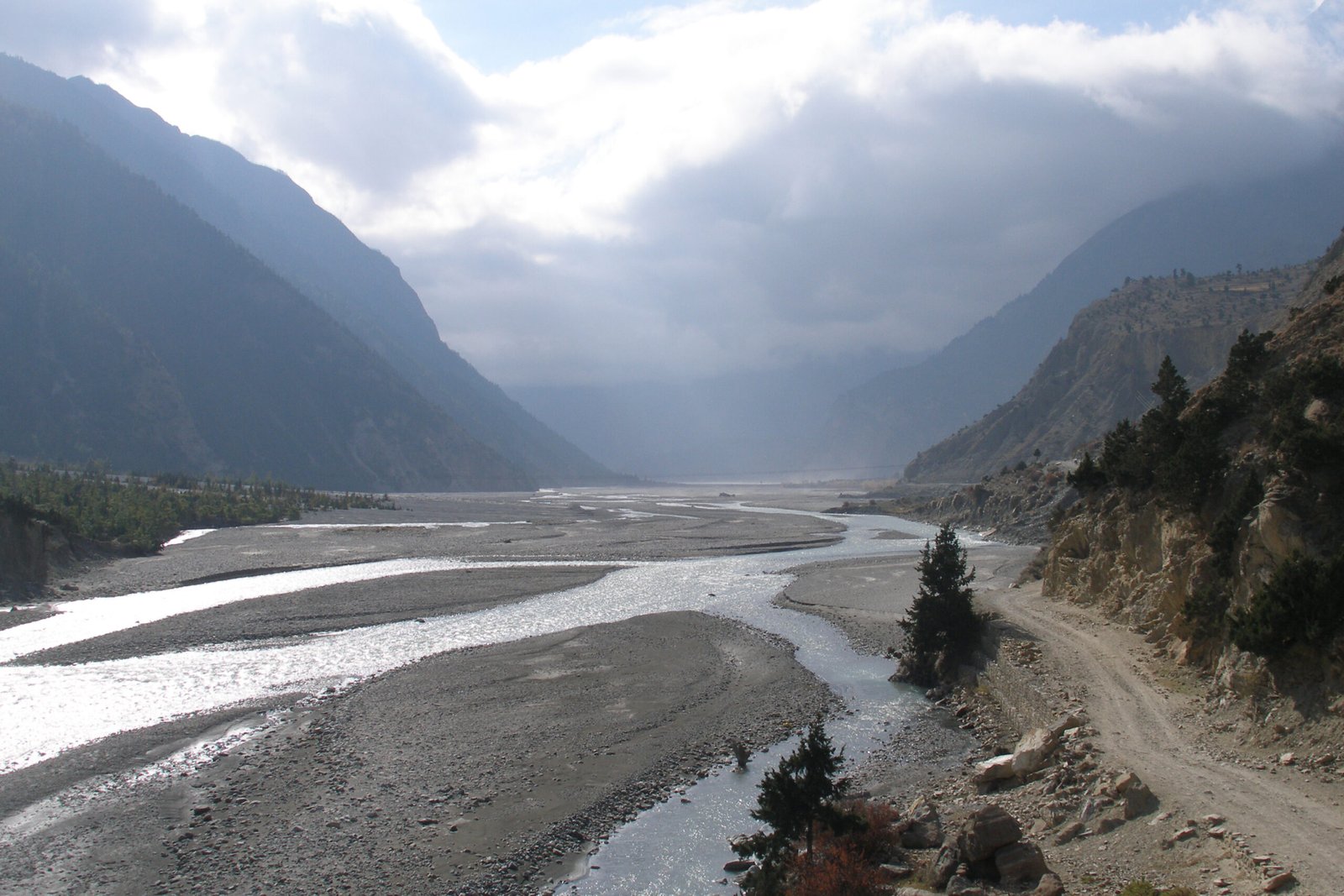
Kaligandaki Corridor Blocked by Dry Landslide in Gulmi
As of Friday, November 6, 2026 (20 Kartik 2083), 11:00 NPT.
A dry landslide has blocked the Rudrabeni-Purtighat section of the Kaligandaki Corridor at Rakse, in Kaligandaki Rural Municipality-2 of Gulmi district, cutting the overland route that feeds the Annapurna region and the upper Kali Gandaki valley. The Road Division Office in Palpa says it has deployed equipment and is clearing the debris to reopen the road. No casualties have been reported. Travellers heading toward Beni, Jomsom, Muktinath, Kagbeni or the Annapurna Circuit should expect delays and confirm the road status locally before setting out.

Key takeaways
- What happened: A dry landslide came down overnight on November 5-6, 2026, blocking the Rudrabeni-Purtighat stretch of the Kaligandaki Corridor at Rakse, Gulmi.
- Who is clearing it: The Road Division Office, Palpa, is using equipment to remove the debris and reopen the section.
- Casualties: None reported.
- Who is affected: Vehicles and travellers on the Kaligandaki Corridor, including those bound for Beni and onward to the Annapurna and Mustang country of the upper Kali Gandaki.
- Status: Blocked, with clearance under way. Confirm with local authorities or your operator before you travel.
Table of contents
- What happened on the Kaligandaki Corridor
- Where is the Kaligandaki Corridor, and why does it matter?
- What is a dry landslide, and why is the dry season risky?
- How this affects trekkers and travellers
- Planning around a corridor blockage
- How to check road and trail conditions
- Frequently asked questions
- Sources
What happened on the Kaligandaki Corridor
According to a report published on the morning of November 6, 2026 by the Nepali-language news portal Online Khabar, a dry landslide (सुक्खा पहिरो) came down overnight at Rakse, in ward 2 of Kaligandaki Rural Municipality in Gulmi district, on the Rudrabeni-Purtighat road section of the Kaligandaki Corridor.
The slide brought material down across the roadway and left the section blocked. The Road Division Office, Palpa, told the outlet that it is using equipment to push the debris aside and reopen the road. The report does not state how much material came down, whether the blockage is complete or partial, or how long the clearance will take.
It is worth being precise about what is and is not confirmed. The blockage itself, its location, the direction that clearance is coming from, and the absence of reported casualties are all stated by the source and can be treated as confirmed. The likely duration of the closure, the number of vehicles stranded, and any alternative arrangements are not yet reported, and readers should treat those as unknown until a further update appears.
This is also not the first time this exact stretch has closed. The same Rudrabeni-Purtighat section, and the same Rakse area of Kaligandaki Rural Municipality-2, was reported blocked by a landslide on September 25, 2026 and again on October 10, 2026, with debris cleared by dozers and excavators in coordination with the local rural municipality and the Road Division Office, Palpa. Local outlets have reported similar closures on this corridor at other points during 2026 as well. The repetition matters: it tells travellers that the Rudrabeni-Purtighat stretch is a recurring trouble spot rather than a one-off incident, and that the risk of a fresh closure is highest after any period of slope instability.
Where is the Kaligandaki Corridor, and why does it matter?
The Kaligandaki Corridor, designated NH48, is a national highway under construction in Nepal. According to reference data on the project, it is a 254-kilometre road that begins at Gaindakot in Nawalpur and runs north to Korala, the crossing point near the Chinese border at the head of the Kali Gandaki valley. It is listed among Nepal’s National Pride Projects, and when complete it is intended to give roughly one million people across ten districts direct motorable access. The route passes through both the mid-hills and the high Himalaya, and the main localities along the way include Palpa, Syangja, Parbat, Baglung and Muktinath. It is also widely discussed as a future trade route linking Nepal with India to the south and China to the north. Construction was started in December 2018 and has been carried out by multiple contractors, including the Nepal Army’s Road Construction Division.
For visitors rather than planners, the corridor matters for a simpler reason: it is the spine of overland access to some of the most popular trekking and pilgrimage country in Nepal.
- Annapurna region: The corridor and its connecting roads feed the Annapurna Circuit and the Annapurna Base Camp approaches, and the town of Beni in Myagdi is a traditional junction for treks into the Annapurna and Dhaulagiri foothills. You can read more in our complete guide to treks in the Annapurna region.
- Mustang and the upper Kali Gandaki: North of Beni, the road climbs the Kali Gandaki valley to Jomsom, Kagbeni and Muktinath, and onward toward the Korala border. This is the overland artery for the Upper Mustang trek and for pilgrims travelling to Muktinath.
- The Annapurna Circuit: Travellers completing the classic circuit use road links through this corridor to reach trailheads and to exit the mountains. Our Annapurna Circuit guide explains the full route and its road sections.
Because so much of that traffic funnels through the same river valley, a single blocked section on the corridor can ripple out to trekkers, pilgrims, locals and cargo alike, even when the landslide itself is small.
What is a dry landslide, and why is the dry season risky?
The report describes the event as a dry landslide, and that term is worth unpacking. A dry landslide is a slope failure that is not triggered by rainfall. Instead, it happens when a mass of rock, soil and debris that has already been weakened moves on its own, often because of a freshly cut or widened road bench, undercutting of a slope, freeze-thaw action at altitude, or simply the slow loss of support on an over-steepened hillside.
In Nepal’s mid-hills, dry landslides are a familiar hazard through the post-monsoon and winter months, from roughly October through the dry spring. The end of the rains does not end the danger on hill roads. Water that soaked into slopes during the monsoon can take weeks to drain and settle, and the drying-out period itself can destabilise material. Meanwhile, road construction and widening along corridors such as the Kaligandaki continue through the dry season, which removes support from slopes and leaves fresh cuts exposed. A slide can therefore come down on a clear, dry night with no warning from the weather.
For anyone travelling on Nepal’s hill highways, the practical implication is that “the rain has stopped” is not the same as “the roads are safe.” Slope failures can and do happen in fair weather, and on roads that are still being built or upgraded the risk is higher.
How this affects trekkers and travellers
At the moment the blockage is localised: a single section between Rudrabeni and Purtighat in Gulmi. The size of its impact depends on how quickly the Road Division Office can clear the debris, and on how travellers and operators reroute or wait it out. Based on how this stretch has behaved through 2026, a closure here has historically been measured in hours to a few days rather than weeks, but nothing in the current report guarantees a fast fix.
Several groups should pay attention:
- Overland travellers to Beni and Mustang: Anyone driving or riding toward Beni as a staging point for Mustang or Annapurna trips may face a wait, a detour, or a change of plan. Build in buffer time and keep your operator informed.
- Pilgrims and visitors to Muktinath and Jomsom: Those heading up the Kali Gandaki valley on the road should expect the corridor to be the pinch point. If a fast alternative by air is part of your plan, remember that mountain flights are weather dependent.
- Trekkers on road-linked itineraries: Many Annapurna-area itineraries depend on vehicles to reach or leave the trail. A corridor closure can affect the start or end of an itinerary even if the walking itself is unaffected.
Corridor status at a glance (November 6, 2026)
| Item | Detail |
|---|---|
| Road | Kaligandaki Corridor (NH48) |
| Section | Rudrabeni to Purtighat |
| Location | Rakse, Kaligandaki Rural Municipality-2, Gulmi |
| Cause | Dry landslide (not rainfall-triggered) |
| Status | Blocked, clearance under way |
| Clearing agency | Road Division Office, Palpa |
| Casualties | None reported |
Source: Online Khabar, November 6, 2026. Status can change within hours.
For travellers who want a guided version of the region once the corridor is clear, Enticing Himalayas runs a 14-day Annapurna Circuit trek that joins the route via Thorong La, which is a natural next step for anyone whose trip hinges on this part of Nepal.
Planning around a corridor blockage
- Check before you move. Do not assume a hill road is open because it was open yesterday. Confirm the current status on the day you travel, ideally through a local operator, hotel or the district traffic police.
- Add buffer time. If your itinerary depends on the corridor, build in at least one spare day so a short closure does not cascade into missed flights or onward bookings.
- Ask about alternatives early. For some journeys there is no practical detour overland, and the honest answer is to wait. Where an air link exists, compare it against a road delay before committing.
- Travel in daylight. Hill-road slope failures are easier to see and safer to handle in daylight, and clearance crews usually work through the day.
- Keep your operator in the loop. If you booked a trek or tour, your operator will typically know the fastest way to adapt. Let them know your dates and constraints.
- Stay flexible on the last leg. The start or end of a trek is often the most road-dependent part of the trip. Treat those legs as movable.
It also helps to remember that this is a corridor still under construction. Parts of the Kaligandaki Corridor remain a work in progress, with active widening, bridge building and slope work along its length. Until the road is fully built and stabilised, seasonal closures on sections such as Rudrabeni-Purtighat are likely to recur.
How to check road and trail conditions
- Local police and district administration: District police offices are the fastest source for a specific road section’s status, and they are routinely quoted in the initial reports of a closure.
- The Road Division Office responsible for the section: For this stretch that is the Road Division Office, Palpa, which is also the body leading the clearance.
- Your trekking or tour operator: Operators running trips in the Annapurna and Mustang areas track these closures as a matter of routine and can advise on rerouting.
- Nepali news outlets: The initial word on hill-road closures usually comes through outlets such as Online Khabar, Khabarhub and MyRepublica, which cover the mid-hills and Gandaki province closely.
- Cross-check the weather and the road together: Weather bulletins tell you about rain and snow, but as this incident shows, a dry-season slope failure can close a road without any weather trigger at all.
For broader preparation, our Nepal trekking safety guide covers health, altitude and contingency planning, and it is worth reading alongside any road or trail update. If your plans run to the northern end of this same corridor, our report on the Korala border crossing is also relevant, since that route faces its own seasonal snow closures. And if you are weighing which roads and trails to build an itinerary around, the Besisahar-Chame road situation in neighbouring Manang is a useful comparison for how quickly mountain road status can change.
Frequently asked questions
Is the Kaligandaki Corridor open right now?
As of the morning of November 6, 2026, the Rudrabeni-Purtighat section in Gulmi is reported blocked by a dry landslide, with the Road Division Office, Palpa, working to clear it. The rest of the corridor is not reported as affected by this specific incident, but status can change within hours, so confirm locally before travelling.
Where exactly is the blockage?
At Rakse, in ward 2 of Kaligandaki Rural Municipality in Gulmi district, on the Rudrabeni-Purtighat road section of the Kaligandaki Corridor. This is the mid-hills stretch of the corridor, downstream of the Beni and Mustang country to the north.
Did the landslide cause any deaths or injuries?
No casualties have been reported. The incident is a road blockage, and there is no report of anyone being caught in the slide.
Does this affect the Annapurna Circuit or the Upper Mustang trek?
It can, indirectly. The trekking routes themselves are on footpaths, but many itineraries use road links through this corridor to reach trailheads or to exit the mountains. A corridor closure can disrupt the road legs of a trek even when the walking is unaffected. Check with your operator if your itinerary uses road transport through Gulmi, Beni or the Kali Gandaki valley.
What is a dry landslide?
A dry landslide is a slope failure that is not triggered by rain. It happens when already-weakened ground moves on its own, often on freshly cut or over-steepened road slopes. In Nepal’s mid-hills these can occur through the dry season, which is why a clear forecast does not guarantee an open road.
How long will the road be closed?
That is not yet reported. Historically, closures on this stretch have been cleared within hours to a few days, but the current report does not give a timeline, and the answer depends on how much material came down. Plan for uncertainty.
Sources
- Online Khabar (Nepali), November 6, 2026: कालीगण्डकी करिडोर अवरुद्ध (Kaligandaki Corridor blocked by dry landslide).
- Khabarhub (English), October 10, 2026: Landslide blocks Kaligandaki Corridor in Gulmi.
- Khabarhub (English), September 25, 2026: Landslide blocks Kaligandaki Corridor in Gulmi.
- MyRepublica, October 10, 2026: Kaligandaki Corridor in Gulmi blocked with landslide.
- Wikipedia: Kaligandaki Corridor (NH48).
This article was published on November 6, 2026. Road status reflects the latest reporting available at the time of writing and can change quickly; always confirm the current situation before travelling.
Share this content: