Seven Road Sections Blocked Across Nepal in August 2026: What Travelers Need to Know
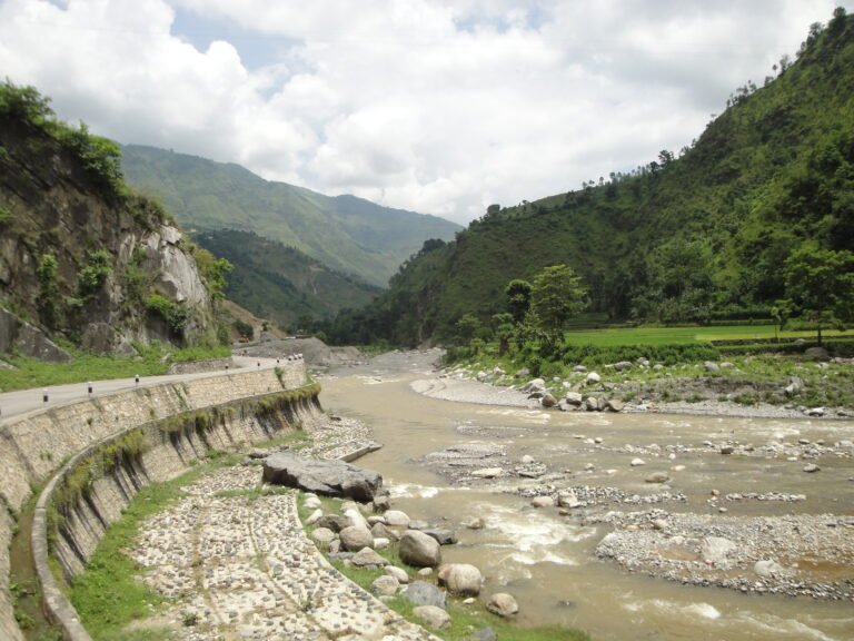
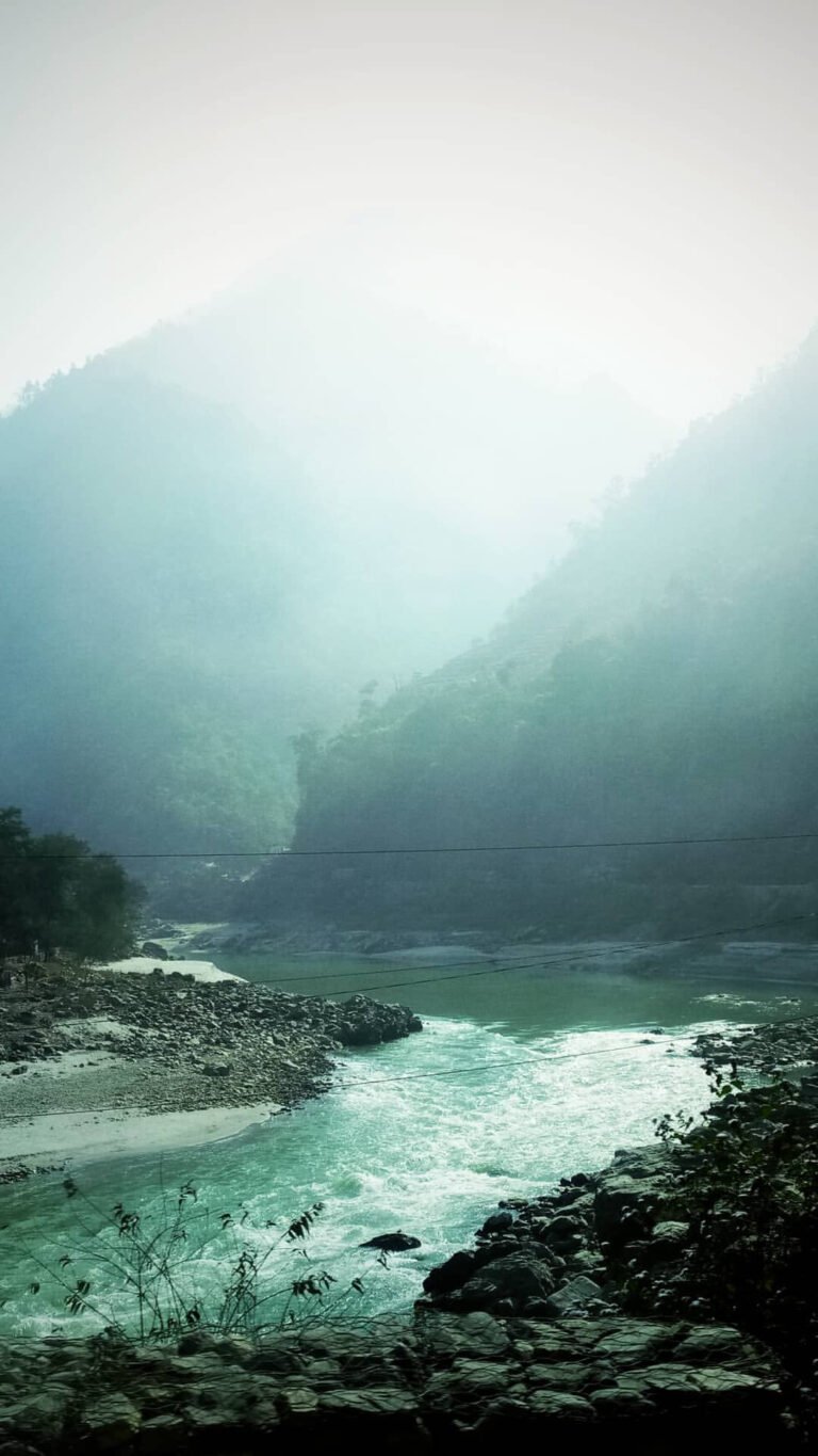
Featured image: The Trishuli Highway (Rajmarg) in central Nepal — one of the seven road sections affected by monsoon damage on August 25, 2026. Photo by Sundar1, CC BY-SA 3.0, via Wikimedia Commons.

As of August 25, 2026 (10:00 AM NPT): Nepal Police has confirmed that at least seven road sections across the country are blocked due to flooding, landslides, debris deposition, and river erosion following heavy monsoon rains. The affected districts include Kavrepalanchok, Sindhuli, Makawanpur, Nuwakot, Ilam, Sindhupalchok, Rasuwa, and Rukum West. For trekkers, tourists, and overland travelers, these disruptions affect key routes to popular trekking destinations including Langtang, the Tibet border via Araniko Highway, and the eastern Terai via BP Highway.
Related guide: Nepal Trekking Safety & Health Complete Guide
Table of Contents
- Summary of All 7 Blocked Road Sections
- BP Highway: Night-Time Closure in Kavrepalanchok
- Araniko Highway: Landslide at Liping Bazaar, Sindhupalchok
- Trishuli–Mailung–Syafrubesi Road: River Erosion in Rasuwa
- Mechi Highway: Complete Blockage in Ilam
- Tokha-Chhahare Road: Night Ban in Nuwakot
- Kanti Lokpath: Night Closure in Makawanpur
- Bheri Corridor: Jajarkot-Dolpa Road Blocked in Rukum West
- What Travelers Should Do Now
- Frequently Asked Questions
- Key Takeaways
Summary of All 7 Blocked Road Sections
According to a report by Rastriya Samachar Samiti (RSS), Nepal’s government-run national news agency, published by Online Khabar on August 25, 2026, the following seven road sections have been affected as of 10:00 AM today:
| # | Road Section | District | Cause | Status |
|---|---|---|---|---|
| 1 | BP Highway (Khurkot–Nepalthok–Katunje Bensi–Sindhuli) | Kavrepalanchok / Sindhuli | Flood risk | Night closure (6 PM–4 AM) |
| 2 | Kanti Lokpath | Makawanpur | Rain | Night closure (5 PM–5 AM) |
| 3 | Tokha-Chhahare Road | Nuwakot | Landslide risk | Night ban (10 PM–5 AM) |
| 4 | Mechi Highway (Rajduwali, Ilam-9) | Ilam | Muddy road | Completely blocked (alternative route available) |
| 5 | Araniko Highway (Liping Bazaar, Bhotechaur-2) | Sindhupalchok | Landslide + debris from Khahare River (since Aug 21) | Completely blocked |
| 6 | Trishuli–Mailung–Syafrubesi Road (Khalte, Uttar Gaya RM-5) | Rasuwa | Trishuli River erosion (road undercut) | Completely blocked |
| 7 | Bheri Corridor (Jajarkot-Dolpa, Rijegad Khola, Aathbiskot-6) | Rukum West | Debris and rockfall | Completely blocked |
Source: Rastriya Samachar Samiti (RSS) via Online Khabar English, August 25, 2026.
BP Highway: Night-Time Closure in Kavrepalanchok
The BP Highway (also designated as NH13) is a vital 160-kilometer highway that links the Kathmandu Valley with the eastern Terai through Kavrepalanchok and Sindhuli districts. Construction began in 1996 with Japanese grant assistance and was completed in July 2015 at a total cost of NPR 21.5 billion.
Due to potential flooding risk along the section running through Kavrepalanchok — specifically the Khurkot–Nepalthok–Katunje Bensi–Sindhuli stretch — all vehicular movement has been suspended from 6:00 PM to 4:00 AM. Vehicles are permitted to operate only during daylight hours, from 4:00 AM to 6:00 PM.
Why this matters for travelers: The BP Highway is the primary alternative route for trekkers traveling from Kathmandu to Manthali (the departure point for Lukla flights to the Everest region) and to the eastern Terai. If you are planning a dawn flight from Manthali to Lukla, note that the highway is closed from 6 PM — meaning you must cross the risk section before the 6 PM cutoff or wait until 4 AM when it reopens. Early-morning departures from Kathmandu to Manthali during the monsoon should be planned with this restriction in mind.
Read our earlier coverage: BP Highway Blocked After Rains Sweep Away Diversions in Kavre
Araniko Highway: Landslide at Liping Bazaar, Sindhupalchok
The Araniko Highway (NH 34) connects Kathmandu with Kodari on the Nepal-China border, approximately 112 kilometers northeast of the Kathmandu Valley. It is one of Nepal’s most dangerous highways due to extremely steep slopes on each side of the road from Tatopani Barabise onwards; massive landslides and bus plunges are not uncommon, especially after rains.
At Liping Bazaar, Bhotechaur-2, Sindhupalchok, the road has been completely blocked since August 21 due to a landslide, compounded by debris and stones deposited by the Khahare River. This blockage has cut off overland access toward the Tibet border crossing at Tatopani.
Why this matters for travelers: The Araniko Highway is the only overland route from Kathmandu to the Nepal-China border at Kodari/Tatopani. While the Tatopani border crossing itself recently reopened after a month-long blockage (see our coverage: Tatopani Border Crossing Reopens After Month-Long Landslide Blockage), this new blockage at Liping Bazaar means that the road to reach the border is once again impassable. Travelers planning cross-border trips to Tibet via this route should check with local authorities before setting out.
Trishuli–Mailung–Syafrubesi Road: River Erosion in Rasuwa
The Trishuli–Mailung–Syafrubesi road section in Rasuwa’s Uttar Gaya Rural Municipality-5, Khalte, has been completely blocked after the Trishuli River eroded the road from below. This is a particularly dangerous form of road damage — rather than debris falling onto the road, the river has undercut the road bed itself, meaning the surface may be structurally compromised even where it appears intact.
The Trishuli River is one of the major tributaries of the Narayani River basin, formed by the merger of the Kyirong Tsangpo and Lende Khola near Rasuwa Gadhi on the Nepal-Tibet border. During the monsoon, the river swells dramatically and its erosive force increases substantially.
Why this matters for travelers: The Trishuli–Mailung–Syafrubesi road is a key access route to Rasuwa Gadhi (the border crossing to Kerung, Tibet) and to the Langtang Valley trek trailhead at Syafrubesi. Trekkers planning a Langtang trek should be aware that the road to Syafrubesi is currently impassable. Alternative access may be available via the Gosainkunda route from Dhunche, but you should verify road conditions with local transport operators before departing Kathmandu.
Mechi Highway: Complete Blockage in Ilam
The Mechi Highway at Rajduwali, Ilam Municipality-9, has been completely blocked due to rain making the road impassable. Vehicles cannot pass because the road surface has turned to mud. However, the police have noted that there is an alternative route available at this location.
Why this matters for travelers: The Mechi Highway is an important road in eastern Nepal, connecting the hill districts of the eastern region. Ilam is known for its tea gardens and is a growing tourism destination. Travelers heading to Ilam or through the Mechi corridor should use the alternative route and expect significant delays. Four-wheeled vehicles with high clearance are recommended during monsoon conditions on this road.
Tokha-Chhahare Road: Night Ban in Nuwakot
The Tokha-Chhahare road section in Nuwakot has had a night-time ban imposed on all public and private vehicles (except those on essential services) from 10:00 PM to 5:00 AM. This restriction is due to landslide risk along the route.
This is a continuation of the pattern we reported earlier this month: Tokha-Chhahare Road Closed at Night: Landslide Risk on Key Nepal-China Border Route. The Tokha-Chhahare road is a newer shortcut route connecting the northern Kathmandu Valley (Tokha) with Nuwakot, reducing travel time to Bidur and beyond toward the Rasuwa/Langtang corridor compared to the older Galchi-Devighat route.
Why this matters for travelers: If you are traveling from Kathmandu to Nuwakot or onward to Langtang via this route, you must complete your journey during daylight hours. The road is narrow and runs through landslide-prone hillside terrain; night travel during monsoon is extremely dangerous and now prohibited.
Kanti Lokpath: Night Closure in Makawanpur
The Kanti Lokpath in Makawanpur has had all vehicle operations prohibited from 5:00 PM to 5:00 AM due to rain. This is one of the more restrictive night-time closures among the seven affected roads, with a 12-hour daily window (5 AM–5 PM) for traffic.
Why this matters for travelers: The Kanti Lokpath is a trail/footpath-turned-road route through Makawanpur district, connecting the Hetauda area with the Chitwan corridor. Travelers heading to Chitwan National Park or other destinations in the Makawanpur-Chitwan corridor should plan their journeys to arrive before the 5 PM cutoff or wait until 5 AM the following morning.
Bheri Corridor: Jajarkot-Dolpa Road Blocked in Rukum West
The Jajarkot-Dolpa road section of the Bheri Corridor in Rukum West’s Aathbiskot Municipality-6, at Rijegad Khola, is completely blocked after stones and soil mixed with debris fell onto the road. This is a remote section of Nepal’s road network serving the far-western mid-hills.
Why this matters for travelers: While this road section is not on the primary trekking circuit, it is significant for trekkers heading to Dolpa (Upper and Lower Dolpa treks) and for those exploring the remote western regions of Nepal. The Jajarkot-Dolpa road is one of the few road access routes to Dolpa district, and its blockage means that flights to Juphal airport (the alternative access to Dolpa) become the only reliable entry point. Trekkers planning a Dolpa trek should monitor this road situation and consider flight options.
What Travelers Should Do Now
Nepal Police has advised all travelers to take precautions when traveling on these roads, as they are getting blocked and risks are increasing due to the rain. Here are concrete steps for trekkers and tourists:
- Check before you depart. Call your trekking agency, hotel, or local transport operator for the latest road conditions on your route. Conditions can change within hours during the monsoon.
- Plan around night-time closures. Three of the seven affected roads (BP Highway, Kanti Lokpath, Tokha-Chhahare) have night-time travel bans. Build your itinerary to arrive at the risk section during permitted daylight hours.
- Carry buffer days. Monsoon road blockages can last from hours to days. Build 1–2 buffer days into your itinerary, especially if you have fixed-date flights from Manthali (Lukla) or onward international connections.
- Consider flight alternatives. Where road access is blocked (Trishuli–Syafrubesi to Langtang; Jajarkot–Dolpa to Dolpa), check whether domestic flights to nearby airstrips (Lukla, Juphal, etc.) are operating. Note that mountain flights are also weather-dependent during the monsoon.
- Monitor official sources. The Nepal Police traffic control room and the Department of Roads issue regular updates. Local news outlets (Kathmandu Post, Online Khabar, The Himalayan Times) provide near real-time reporting on road conditions.
- Do not travel at night on landslide-prone roads — even where no formal ban is in place. Visibility is poor, and landslide debris can fall onto the road without warning during heavy rain.
- Have travel insurance that covers trip interruption. Road blockages are a leading cause of missed flights and itinerary changes during the Nepali monsoon (June–September). A comprehensive policy that covers trip delays and additional accommodation costs is essential.
For a comprehensive guide to trekking safely in Nepal during the monsoon, see our Nepal Trekking Safety & Health Complete Guide.
Frequently Asked Questions
How many road sections are currently blocked in Nepal?
As of August 25, 2026, at 10:00 AM, Nepal Police has confirmed seven road sections blocked across eight districts: Kavrepalanchok, Sindhuli, Makawanpur, Nuwakot, Ilam, Sindhupalchok, Rasuwa, and Rukum West. The causes include flooding, landslides, debris deposition, and river erosion following monsoon rains.
Is the BP Highway open for travel?
The BP Highway is open during daylight hours only — from 4:00 AM to 6:00 PM — due to flood risk along the Kavrepalanchok section. Night-time vehicular movement (6 PM to 4 AM) is prohibited until further notice.
Can I still reach the Tatopani border crossing on the Araniko Highway?
The Araniko Highway at Liping Bazaar, Sindhupalchok, has been completely blocked since August 21 due to a landslide and debris from the Khahare River. While the Tatopani border crossing itself reopened recently, the road to reach it is currently impassable at Liping Bazaar. Check with local authorities before attempting this route.
Is the road to Langtang (Syafrubesi) open?
No. The Trishuli–Mailung–Syafrubesi road section in Rasuwa is completely blocked due to the Trishuli River eroding the road from below. This affects access to the Langtang Valley trek trailhead. Trekkers should check for alternative routes via Dhunche or consider whether the trek is feasible at this time.
What should trekkers do if their road to the trailhead is blocked?
First, check with local transport operators for alternative routes or updated road conditions. If no road access is available, consider whether a domestic flight to a nearby airstrip is possible. Build buffer days into your itinerary for monsoon travel, and ensure your travel insurance covers trip delays and interruptions caused by natural events.
When will these roads reopen?
There is no official timeline for reopening. Road clearance depends on weather conditions, the severity of damage, and the availability of heavy equipment in the area. Some sections (like the Araniko Highway at Liping Bazaar) have been blocked for four days (since August 21). Monitor local news and Nepal Police updates for the latest status.
Is it safe to travel in Nepal during the monsoon?
Travel in Nepal during the monsoon (June–September) is possible but carries higher risks of road blockages, landslides, and flight cancellations. The key is to stay informed, travel during daylight hours, follow police advisories, and maintain flexible itineraries. Many trekkers successfully trek in Nepal during the monsoon by choosing rain-shadow regions (like Mustang and Dolpo) and building buffer days.
Key Takeaways
- Seven road sections across eight Nepali districts are blocked or restricted as of August 25, 2026, due to monsoon-related flooding, landslides, and river erosion.
- Three roads have night-time closures: BP Highway (6 PM–4 AM), Kanti Lokpath (5 PM–5 AM), and Tokha-Chhahare (10 PM–5 AM).
- Four roads are completely blocked: Mechi Highway in Ilam (alternative available), Araniko Highway at Liping Bazaar (since Aug 21), Trishuli–Syafrubesi in Rasuwa (river erosion), and Bheri Corridor Jajarkot-Dolpa in Rukum West.
- Trekking impact: Access to Langtang (Syafrubesi) and the Tibet border (Araniko Highway) is currently cut off. The BP Highway night closure affects Manthali/Lukla flight connections.
- Always check road conditions before departing during the monsoon — conditions can change within hours. Follow Nepal Police advisories and local news for updates.
- Build buffer days into your itinerary and carry comprehensive travel insurance that covers trip delays and interruptions.
Sources: Rastriya Samachar Samiti (RSS) via Online Khabar English (August 25, 2026); Wikipedia (BP Highway, Araniko Highway, Trishuli River — background facts). Additional context from Nepal Police traffic advisory.
Published: August 25, 2026. This is a developing story — road conditions may change rapidly. Verify with local authorities before traveling.
Related Guides
- BP Highway Blocked After Rains Sweep Away Diversions in Kavre
- Tatopani Border Crossing Reopens After Month-Long Landslide Blockage
- Tokha-Chhahare Road Closed at Night: Landslide Risk on Key Nepal-China Border Route
- Prithvi Highway Landslide Blocks Traffic in Tanahun
Share this content: