Besisahar Chame Road Heavy Vehicle Ban: What Annapurna Trekkers Need to Know (September 2026)
Update, Saturday 12 September 2026: This road is now fully closed to all vehicles, including tourist jeeps, from 09:00 to 17:00 on Saturday 12 September 2026 for concreting at Dharapani, with heavy vehicles banned until 10:00 Sunday morning. See the full update: Besisahar-Chame road closed today: Annapurna Circuit access update.
TravellingNepal quick answer: Residents of Manang have stopped heavy vehicles from using the Chame-Besisahar road, the district’s only road lifeline, because continuous monsoon rain has left the route fragile and dangerous. As of Sunday, 6 September 2026, the blockade is a local protest action coordinated with the Lamjung administration and the Dumre-Besisahar-Chame road project, and it primarily targets construction trucks belonging to under-construction hydropower projects. Tourist jeeps, land cruisers and local passenger jeeps are not the focus of the ban, but anyone heading to Manang or the Annapurna Circuit trailhead in the coming days should confirm ground transport status before travelling, keep plans flexible, and follow official guidance.
The protest began on 21 Bhadra (Sunday, 6 September) after repeated appeals to heavy-vehicle operators went unheard, according to a report by Online Khabar. Locals say the road has become so degraded that even walking along it has become difficult, and they fear that continued heavy-truck traffic during the monsoon could sever Manang’s only road connection entirely, right before the autumn trekking season.

Why This Road Matters to Every Annapurna Trekker
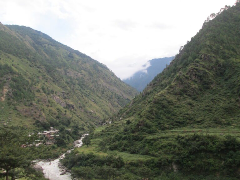
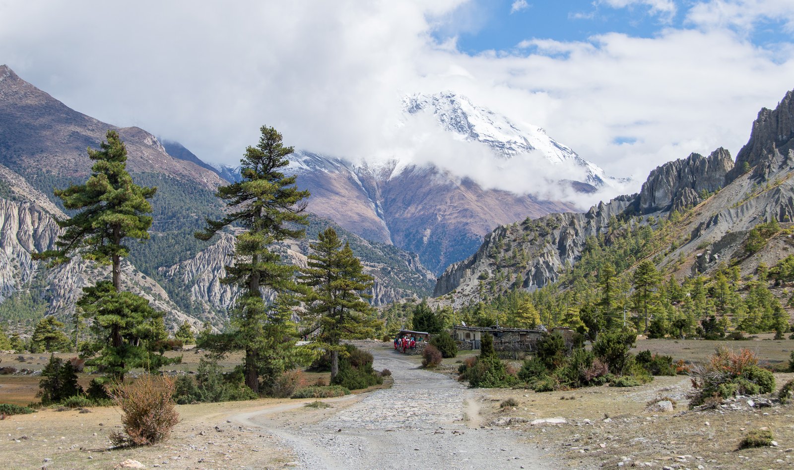
The Besisahar-Chame road is the gateway to the Annapurna Circuit, one of the world’s classic long-distance treks. The circuit’s trail begins at Besisahar or Bhulbhule in the Marsyangdi river valley, roughly a seven-hour drive from Kathmandu. From there, the route climbs through Chame, the district headquarters of Manang, and on through Upper Pisang, Manang and over the 5,416-metre Thorong La pass to Muktinath and the Kali Gandaki valley.
The Annapurna Conservation Area, through which the road runs, is Nepal’s largest protected area, covering 7,629 square kilometres across Manang, Mustang, Kaski, Myagdi and Lamjung districts. The road is not merely a trekking support route: it is the supply line for every lodge, teahouse and village between Besisahar and the Tibetan border trade posts. When it is blocked, food prices rise, fuel disappears, and rescue logistics become complicated.
What Exactly Happened on the Besisahar-Chame Road?
According to Online Khabar’s report of 6 September 2026, residents of Marsyangdi Rural Municipality and surrounding areas physically blocked heavy vehicles from using the Chame-Besisahar road. The action was taken after locals said their earlier appeals were ignored. Key facts from the report:
- Who: Local residents of Manang, including people from Marsyangdi Rural Municipality Ward 4 (Chamche), supported by provincial parliament members Tekbahadur Gurung and Dharmaraj KC.
- What: A halt on large vehicles, especially heavy trucks serving under-construction hydropower projects, on the Chame-Besisahar road during the monsoon.
- Why: Continuous rain has made the road fragile; heavy vehicles create deep potholes, and sections risk collapse. Locals say the muddy surface has made it hard even to walk to collect fodder or take children to school.
- Where: The Chame-Besisahar road, Manang’s only road link to the rest of Nepal.
- When: From 21 Bhadra (Sunday, 6 September 2026), announced locally and confirmed by the Online Khabar report.
- Administration’s position: Manang’s Chief District Officer Muktiprasad Khanal confirmed the administration had already asked heavy-vehicle operators by phone not to run vehicles during the monsoon, and said coordination with locals is ongoing and their grievances will be heard.
Why Locals Took Action: The Story Behind the Ban
Several residents quoted in the Online Khabar report described a daily life that has become impossible because of the damaged road. Sombahadur Tamang of Marsyangdi Rural Municipality Ward 4, Chamche, said the road had become so risky that locals felt forced to act after repeated appeals produced no response. He noted that the road runs along the very route that international tourists use to visit the Annapurna Conservation Area, yet residents could not walk or carry out their daily routines on it.
Suryakumari Gurung said collecting grass and firewood had become difficult and children could not walk to school safely on the muddy surface. She described a fear that vehicles would slip in the mud and cause accidents, or that children would give up on school rather than walk through the mire.
Parliament member Tekbahadur Gurung supported the ban, explaining that heavy vehicles during the monsoon risk breaking the road, and that rebuilding it would not be possible for a long time. He said the group had appealed to the administration to stop heavy vehicles in the monsoon because a road collapse would cut off the transport of essential goods for tourists and locals alike.
Parliament member Dharmaraj KC said the ban’s aim is protective: if heavy vehicles are run without care during the monsoon, the road could collapse, and Manang’s connection to other areas would be severed.
Manang CDO Muktiprasad Khanal acknowledged the complaint, telling Online Khabar that the administration had already appealed by phone to heavy-vehicle operators not to run vehicles in the monsoon because hill roads are vulnerable to collapse and landslide blockage. He added that if the road breaks because of traffic pressure, reopening it will not be easy, and that the administration is coordinating with residents so their grievances are heard.
What This Means for Trekkers Heading to the Annapurna Circuit
For international trekkers planning an Annapurna Circuit, Annapurna Circuit with Tilicho Lake, or Manang-side trips this autumn, the practical effects are limited but real:
- Tourist transport is not the target. The ban targets heavy trucks, particularly those serving under-construction hydropower projects. Passenger jeeps and tourist vehicles that have long operated on this road are not the immediate focus, though enforcement is informal and local.
- Expect slower journeys and possible checks. Locals are physically enforcing the halt, so any vehicle considered large may be turned back at informal checkpoints.
- Supply lines may tighten briefly. If hydropower trucks are stopped, some goods currently moved by truck may shift to smaller vehicles, which can mean brief gaps on lodge shelves in Manang’s villages.
- Monitor before you go. Check with your trekking agency or guesthouse operator in Besisahar or Chame for the latest status before committing to a fixed itinerary.
- Have a plan B for weather. The ban exists because of monsoon damage. September weather in the Marsyangdi valley can still deliver heavy rain; the same storms that close roads also make trails slippery and viewpoints cloudy.
Annapurna Circuit Access: Practical Alternatives
The Annapurna Circuit’s classic anti-clockwise route, the direction most trekkers use for gentler acclimatisation, typically starts from Besisahar or Bhulbhule and ends at Jomsom or Pokhara. If road transport beyond Besisahar is interrupted, trekkers have several options:
| Situation | Option | Notes |
|---|---|---|
| Heavy vehicles stopped only | Continue by local jeep | Local passenger jeeps are the normal transport on this corridor; the ban is aimed at trucks |
| Full local blockade | Start trekking from Besisahar/Bhulbhule on foot | The classic walking route begins here anyway; adds 1-2 extra days versus jeep to Chame |
| Weather-worn patience | Build buffer days | Monsoon tail-end storms can hold up any Himalayan road; buffer days protect your Thorong La crossing |
| Need altitude help fast | Himalayan Rescue Association post at Manang | The HRA aid post in Manang operates during the main season; altitude illness needs immediate descent or evacuation |
Trekkers should also remember the altitude logic of the circuit: the trail climbs gradually from about 600 metres at the road-head to the 5,416-metre Thorong La, which is why the anti-clockwise direction is safer for acclimatisation. Walking from Besisahar rather than taking transport shortcuts is not a downgrade; it is the traditional, medically safer way the route was designed to be walked.
How This Fits Nepal’s Bigger Monsoon Road Picture
The Besisahar-Chame ban does not exist in isolation. It comes at the end of a brutal monsoon season in Nepal. In late August, a catastrophic flood on the Bhotekoshi River in Rasuwa killed dozens and left hundreds missing, washing away sections of the road to Rasuwagadhi and damaging hydro projects along the Trishuli corridor. The Prithvi Highway, the main Kathmandu-to-Pokhara link, was blocked at Krishnabhir in Dhading earlier in September, pushing traffic onto longer alternate routes. And on the Manaslu Circuit, a flash flood at Namrung in Gorkha on 6 September and a subsequent formal trail-closure notice for the Larke Pass trail underscored how quickly monsoon hazards reshape trekking plans.
Read our coverage of these events: the Prithvi Highway closure at Krishnabhir, the Rasuwa Bhotekoshi flood and rescue update, and the Manaslu Larke Pass trail closure. For the wider autumn picture, see our complete guide to Annapurna region treks and our Annapurna Circuit 2026 route guide.
Monsoon Roads vs. Autumn Dreams: Timing Your Annapurna Trip
September sits in the awkward overlap between monsoon tail and autumn season. The heavy-vehicle ban is a reminder that Nepal’s mountain roads are seasonal instruments. The autumn trekking window, roughly late September through November, is the busiest and most reliable for the Annapurna Circuit because rainfall drops, skies clear and lodge supply chains restock. But the first weeks of the window are still monsoon-adjacent: roads damaged by summer rain are at their most fragile just as visitor numbers begin to climb.
Practical timing advice for 2026:
- Early October is the sweet spot for road conditions. By then, monsoon repair works are usually complete, and the heavy-vehicle restrictions of September have typically been lifted as rains ease.
- Book flexible accommodation in Manang and Chame. Autumn lodges fill fast; if road problems delay you, a booking that allows date changes saves money.
- Watch the forecast, not the calendar. Monsoon withdrawal varies by year; a dry Bhadra does not guarantee a dry early October.
- Consider a guide for early-season trips. Guides track road status, weather and trail conditions daily and can reroute a trek when a valley closes.
Permits You Still Need Whatever the Road Does
Road disruptions do not change permit rules. Trekkers heading into the Annapurna Conservation Area still need the same documentation in September 2026 as in any season:
- ACAP entry permit (Annapurna Conservation Area Project), mandatory for all trekkers entering the conservation area.
- TIMS card (Trekkers’ Information Management System), required for organised or independent trekking.
- Checkpoint registration at Besisahar and along the route.
Full details, current fees and step-by-step application guidance are in our guide to Nepal trekking permits 2026: TIMS, ACAP and MCAP fees.
Frequently Asked Questions
Is the Besisahar-Chame road closed to tourists?
Not as a matter of policy. The current action is a local protest targeting heavy trucks, mainly those serving under-construction hydropower projects. Local passenger jeeps and tourist transport have historically used this corridor, but enforcement is informal and can change day to day. Check the latest status with your agency or with guesthouse operators in Besisahar or Chame before travelling, and treat any information older than a day or two as outdated.
Will this affect my Annapurna Circuit trek in October?
Probably not. The ban is a monsoon-season measure; parliament members and the administration explicitly framed it around monsoon risk. Historically, once the monsoon ends and repairs are done, such restrictions are relaxed. October trekkers should monitor updates in the week before departure, but there is no indication this is a permanent closure.
Can I still reach Manang by road?
As of 6 September 2026, the restriction targets heavy vehicles rather than passenger transport. The road itself remains the only surface link to Manang district, and local jeep services have continued to operate on this corridor through past disruptions. Alternative access is limited: Manang Airport at Humde, one of the world’s highest airports at 3,353 metres, serves the district but has no regular commercial schedule you can count on; the realistic backup is to start walking from Besisahar or Bhulbhule, which is the classic start of the Annapurna Circuit anyway.
What happens if the road fully collapses?
A full collapse would cut vehicle access to Chame and beyond, but not pedestrian access: the Annapurna Circuit trail itself is a walking route, and trekkers have walked it from Besisahar for decades. Supplies would move by mule train and porter as they did before the road was built. Emergency evacuation would shift to helicopter, which insurance-backed trekkers can already arrange. The biggest cost would be time, not safety, provided you carry buffer days.
Is it safe to trek the Annapurna Circuit in September?
September is a transition month. Early September carries monsoon risks: landslides, swollen rivers, leeches on lower sections and obscured views. Late September, as the monsoon withdraws, is one of the nicest times on the circuit: quieter trails than October, green terraces, and the first clear mountain mornings. The 2026 monsoon has been unusually destructive, so this September demands extra caution, weather awareness and flexibility. Check weather advisories, keep buffer days, and consider hiring a guide if you are inexperienced in monsoon mountain travel.
Where can I get official updates?
The Manang District Administration Office is the authoritative local source. Your trekking agency or guide in Kathmandu, Besisahar or Chame will usually have the freshest practical information. National dailies including Online Khabar, The Kathmandu Post and others report significant road changes quickly. TravellingNepal will update this article as new information is confirmed.
Key Takeaways for Travellers
- Heavy vehicles are blocked on the Chame-Besisahar road by local action from 6 September 2026, targeting monsoon road damage caused chiefly by construction trucks.
- Tourist and passenger transport is not the primary target, but status can change quickly; confirm locally before travelling.
- The road is the gateway to the Annapurna Circuit; if vehicle access tightens, start walking from Besisahar or Bhulbhule, the classic trailhead.
- Permits (ACAP, TIMS) are unchanged; apply in advance through official channels.
- Build buffer days into any September or early-October itinerary in the Nepal Himalaya during this unusually harsh monsoon year.
- October and November remain the prime, most reliable window for the Annapurna Circuit.
Related Guides on TravellingNepal
- Annapurna Region Treks: Complete Guide
- Annapurna Circuit Trek 2026: Route, Thorong La and Trail Changes
- Trekking Permits in Nepal 2026: TIMS, ACAP and MCAP Explained
- Seven Road Sections Blocked Across Nepal (August 2026 Update)
- Manaslu Larke Pass Trail Closure: September 2026
- Prithvi Highway Closure at Krishnabhir: What Travellers Need to Know
Sources
- Online Khabar, 6 September 2026: Ban on large vehicles on Besisahar-Chame road (Nepali language; primary source for all quotes and facts in this article).
- Wikipedia: Annapurna Circuit; Annapurna Conservation Area; Manang Airport (background facts: route length, districts covered, Thorong La elevation, airport elevation).
Published: 7 September 2026. This article will be updated as the situation develops.
Share this content: