Nepal Seeks Mountain Early-Warning Systems at COP31
As of Thursday, November 12, 2026 (26 Kartik 2083).
Nepal is calling for mountain-specific early warning systems, stronger cross-border data sharing and predictable, grant-based climate finance, Foreign Minister Shisir Khanal told a high-level gathering at the COP31 climate summit in Antalya, Türkiye, warning that the current system is not enough to protect communities living beneath the high Himalayas. The argument has a direct travel angle: the same warning chain officials are debating is the one that decides whether a flash flood, a fresh landslide or a blocked highway reaches trekkers and drivers in time.

Key takeaways
- The news: Foreign Minister Shisir Khanal told a COP31 event in Antalya, Türkiye, that existing warnings are not enough for mountain countries and called for mountain-specific forecasting, high-altitude monitoring and grant-based climate finance.
- The quote: “In the early minutes of a disaster, our early warning system sent millions of SMS, and downstream communities did receive localised warnings, but it wasn’t enough.”
- Why it matters to travellers: the same warning chain governs weather alerts, trail closures and road status in the hills. A weak link at altitude can mean news of a hazard never reaches the valley road you are driving or the trail you are walking.
- The trigger event: floods on August 26, 2026, hit the Bhotekoshi and Trishuli corridors, both fed by headwaters high in the Nepal Himalaya.
- Status: these are requests and proposals, not decisions. No new system is operating yet; travelers should keep relying on live weather and road checks.
Table of contents
What Nepal asked for at COP31
Khanal was speaking at a high-level event titled “Early Warnings for All: Delivering on Our Promise to Protect Everyone”, held on the sidelines of the 31st Conference of the Parties to the United Nations Framework Convention on Climate Change (COP31) in Antalya, Türkiye. He described early warning as a lifeline for communities in disaster-prone mountain regions, according to The Kathmandu Post.
“In the early minutes of a disaster, our early warning system sent millions of SMS, and downstream communities did receive localised warnings, but it wasn’t enough,” he said, referring to shortcomings exposed by recent disasters.
His asks fall into four buckets:
- Mountain-specific forecasting. Khanal said mountainous countries such as Nepal face particular difficulty forecasting and responding to climate-related disasters because of challenging terrain, inadequate observation infrastructure and the cascading effects of glacial and hydrological hazards. A hazard that starts as a glacier or a slope failure high up does not behave like a rain-fed river flood, so a warning system built for plains and deltas will miss it.
- Better high-altitude monitoring. He called for real-time telemetry, satellite-based remote sensing and cryosphere monitoring adapted to complex mountain environments. In practice that means instruments watching glaciers, glacial lakes and steep, unstable slopes, and not only river gauges far downstream where the water is already arriving.
- A stronger “last mile”. Alerts must reach vulnerable communities in accessible formats and local languages, and be paired with timely anticipatory action. A warning only works if it triggers an evacuation, a trail closure or a halt to traffic while there is still time.
- Cross-border data sharing and money. Khanal invoked Nepal’s “Sagarmatha to the Sea” framing to argue for cooperation between countries that share interconnected river systems and mountain ecosystems, and urged the international community to provide predictable, accessible, grant-based climate finance rather than loans that deepen debt.
He also called for greater global solidarity to address the cascading effects of climate-induced disasters, which he said increasingly threaten lives, livelihoods and infrastructure in both mountain and downstream regions.
Why mountains are so hard to warn
An early warning system is not a single siren on a pole. In the standard technical definition, it is a chain of information and communication systems, built from sensors, event detection and decision subsystems, that forecasts and signals a disturbance early enough for people to prepare. To be effective it needs four working parts: risk analysis, monitoring and warning, dissemination and communication, and a response capability.
Break any one link and the whole chain fails, which is exactly the problem in the Nepal Himalaya. A few structural weaknesses stand out:
- Sparse instruments at altitude. Weather stations and river gauges cluster in accessible valleys and near towns. The high catchments where floods, glacial lake outbursts and slope failures begin are thinly observed, so the first data often arrives only after the hazard is already moving.
- Fast, sediment-heavy flows. A debris flow or a glacial outburst can travel faster than a normal flood and can carry boulders, trees and mud that close roads and sweep away bridges. By the time a downstream gauge registers the surge, the warning window may be minutes.
- Remote settlements and dead zones. Many trekking valleys have patchy mobile coverage and no reliable internet. An SMS alert is only useful where there is a signal and a charged phone.
- Cascades and borders. The same river can be a hazard in Nepal, a water source in India and part of a basin that begins in Tibet. A warning system that stops at a border cannot track the hazard.
None of these gaps is unique to Nepal, but the combination of extreme terrain, monsoon intensity and a growing population of trekkers and road users in the hills makes the stakes unusually high. That is the case Khanal took to Antalya.
The August 26 flood that exposed the gaps
Nepal’s own recent disaster is the reference point for the summit appeal. Floods on August 26, 2026, triggered by extreme rainfall and mountain hazards, caused widespread destruction in several districts, particularly along the Bhotekoshi and Trishuli river corridors, The Kathmandu Post reported.
An analysis in the Nepali Times describes the trigger in starker terms. It says a glacier on the slope of Langtang Lirung collapsed after thawing permafrost weakened the mountain’s structural integrity, sending ice, rock and water down to the valley floor in what the piece calls a “mountain tsunami”. That framing matters, because it is the opposite of a warning-friendly event: a primed slope that fails with little surface warning, high in a valley, and sends its energy downstream fast.
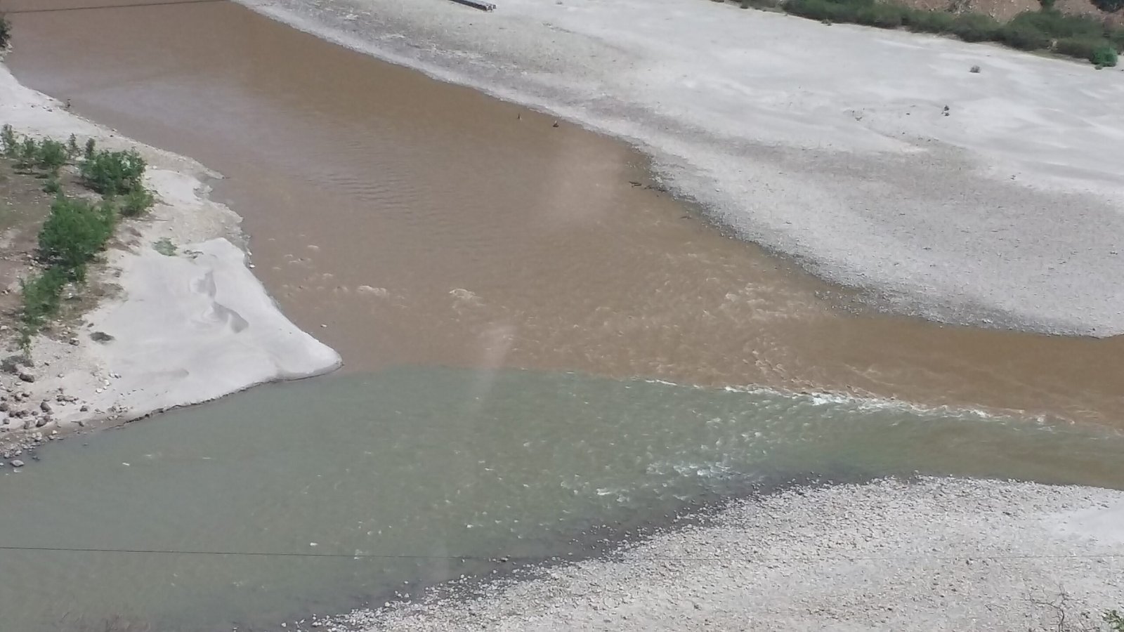
The rivers themselves explain why the damage spread so far. The Bhotekoshi is the upper course, and main tributary, of the Sun Koshi, part of the Koshi river system that drains much of eastern Nepal. The Trishuli, one of the major tributaries of the Narayani basin in central Nepal, is formed where the Gyirong Tsangpo and the Lende Khola meet near Rasuwa Gadhi on the Nepal-Tibet border, and its valley was the traditional trade route between the Kathmandu Valley and Tibet.
Both corridors carry highways, hydropower projects, settlements and trekking access routes. Both are fed by headwaters high in the same range. That is the cascade officials are trying to design warnings for: a hazard born at altitude, moving downstream through valleys where people live, farm, trek and drive.
The aftermath has run for months. Road recovery after the floods dragged on into the autumn, and access to some trekking areas stayed restricted for weeks. Travelers who moved through the affected corridors this season will recognise the pattern: routes that reopen, then close again at the first heavy rain.
What early warning means for trekkers and travellers
Summit language about “telemetry” and “cryosphere monitoring” can sound remote, but it maps onto fairly practical questions for anyone on a trail or a highway in the hills. Here is what a good warning chain is supposed to deliver, and what you should do with it.
| Hazard | What a functioning warning gives you | What you should do |
|---|---|---|
| Flash flood in a river corridor | Advance notice of a surge moving down a specific valley, sent to communities and road users downstream | Never camp or park on a gravel riverbed or a low bridge approach; move to high ground on a named warning |
| Landslide or slope failure on a highway | Route status and closure notices, so drivers can wait or reroute instead of arriving at a blocked bend | Check road status the morning of travel; keep a day of slack; never cross a fresh slip or a moving slope |
| Glacial lake outburst flood (GLOF) | Monitoring of the lake and an alert to valleys below, where the surge arrives fast and dirty | Follow official trekking advisories for GLOF-prone valleys; avoid camping on the flood path of a known lake |
| Snow, whiteout or high wind at altitude | Mountain weather forecasts and pass advisories for high routes | Build weather days into the itinerary; turn back at the first sign of a deteriorating forecast |
| Heavy monsoon rain on a trekking route | Regional weather bulletins and trail-condition updates | Time high passes for the morning; know your next safe lodge or settlement |
The single most useful habit is to treat weather and route status as live variables, not background information. The Department of Hydrology and Meteorology issues the official weather bulletins, and the Nepal Tourism Board publishes mountain-safety guidance at its “before you come” section. Neither will follow you onto the trail, so check both before you set out and again each morning.
“Sagarmatha to the Sea” and the mountain agenda
Sagarmatha is the Nepali name for Mount Everest, the highest mountain on Earth at 8,848.86 m. “Sagarmatha to the Sea” is Nepal’s shorthand for a simple idea: hazards born in the mountains do not stop at a border or at the foothills. Melting glaciers feed rivers that cross into India and Bangladesh; floodwater and sediment travel far downstream. Nepal has long argued that this makes the Himalaya a global, not just a national, responsibility.
The Nepali Times reports that Khanal also attended a PreCOP meeting held in Fiji and Tuvalu last month, where vulnerable island states adopted the Taku Pakasoa Declaration, emphasising unity and action, and that Prime Minister Balendra Shah has taken a more political line on climate action. The same analysis argues that adaptation alone will not stop Himalayan glaciers melting and that mitigation is also needed; that is a column’s opinion, not a government position, but it explains why the Antalya talks are being watched closely in Kathmandu.
The wider COP31 session echoed the mountain theme. As reported by Online Khabar (in Nepali), COP31 President Murat Kurum cited Nepal’s devastating floods and landslides alongside Pakistan’s floods and rising sea levels in Pacific island states, and noted that in 2024 the global average temperature passed 1.5 degrees Celsius above pre-industrial levels. UNFCCC Executive Secretary Simon Stiell said international cooperation had pulled the projected warming path down from above 4 degrees to about 2.6 degrees, and put National Determined Contribution implementation, electrification of economies and climate-finance access at the top of the summit agenda. The talks chair, Chris Bowen, said the world is confronting an energy-security crisis, war and the climate crisis at the same time, and pointed to roughly USD 2.2 trillion of clean-energy investment last year, about double the money still flowing into fossil fuels.
What travellers should do now
Nothing announced at COP31 changes conditions on the ground today. Until a stronger warning chain exists, the practical protection for a traveller in Nepal is still personal preparation. A short checklist:
- Know the season. The heaviest flood and landslide risk runs through the monsoon, roughly June to September, when trails and hill highways are most fragile. The autumn and spring windows are calmer but not risk-free, as the November corridor closures this year showed.
- Check the forecast twice. Look at the Department of Hydrology and Meteorology bulletins in the days before you travel and again on the morning itself. Weather in the hills turns faster than a weekly forecast suggests.
- Verify route status on the day. Highways and trekking routes in the hills can close on a morning’s notice. Ask your lodge, your guide or a local police post about the road or trail ahead before committing to it.
- Build in slack. Plan an extra day around any high pass, river crossing or landslide-prone highway section. Schedules that assume every road is open convert a manageable delay into a crisis.
- Ask about contingency plans. A reputable trekking operator or transport provider should be able to tell you what happens if a route closes, where you would wait and how you would reroute.
- Never cross a flooded stream or a fresh slip. A debris flow or a swollen river can look passable and then move in seconds. Waiting is almost always the right call.
- Carry power and offline maps. Alerts need a working phone; download offline maps and carry a power bank so a dead battery never costs you the one message that matters.
Frequently asked questions
What is Nepal asking for at COP31?
Mountain-specific early warning systems, better high-altitude monitoring through telemetry, satellites and cryosphere monitoring, stronger delivery of alerts to local communities in accessible formats and languages, cross-border data sharing, and predictable grant-based climate finance.
Does this change anything for travellers right now?
No. These are proposals. No new system is in operation, so trekking and driving conditions depend on the existing weather bulletins and road-status checks. Keep treating forecasts and route updates as live information.
What was the August 26 flood that Nepal refers to?
Floods and landslides on August 26, 2026, caused widespread destruction in several districts, particularly along the Bhotekoshi and Trishuli river corridors. A Nepali Times analysis attributes the event to a glacier collapse on the slope of Langtang Lirung after permafrost thaw.
What does “Sagarmatha to the Sea” mean?
It is Nepal’s framing that hazards originating in the Himalayan mountains, including floods and sediment, travel downstream across borders and affect countries far from the mountains. Sagarmatha is the Nepali name for Mount Everest.
What is COP31?
The 31st Conference of the Parties to the United Nations Framework Convention on Climate Change, hosted in Antalya, Türkiye, in November 2026. It is the annual meeting at which governments negotiate climate commitments and finance.
Is trekking in Nepal safe at the moment?
Nepal’s main trekking regions are open, but conditions vary by valley and season, and individual routes and hill highways can close temporarily after heavy rain. Check current advisories, travel with a registered guide where required, and follow local guidance on the ground. For a fuller picture of mountain risk, see the linked guide below.
Sources
- The Kathmandu Post, “Nepal seeks mountain-specific early warning systems after devastating flood”, by Anil Giri, published November 12, 2026. kathmandupost.com
- Online Khabar (Nepali language), report on the COP31 high-level session in Antalya, November 12, 2026. onlinekhabar.com
- Nepali Times, “Core and periphery at COP31” (analysis), November 10, 2026. nepalitimes.com
- Nepal Tourism Board, “Safety in the Mountains”, before-you-come section. ntb.gov.np
- Wikipedia, for background on the Bhotekoshi and Trishuli rivers, early warning systems and Mount Everest.
Related guides on TravellingNepal.com
Share this content: