Gosaikunda Is Filling Again — but the Route In Is Not the One in Your Guidebook
KATHMANDU, November 12, 2026 (Kartik 26, 2083) – For ten weeks the road north from Betrawati ended where a bridge used to be, and the trail above Dhunche carried more repair crews than trekkers. This week the district’s own officials began talking about recovery instead of shutdown: visitor numbers at Gosaikunda, the lake at 4,380 metres that anchors Langtang National Park, are climbing again.

Key takeaways as of Thursday, November 12, 2026:
- The news: Gosaikunda Rural Municipality says visitor numbers are climbing again after the August 26 Bhotekoshi flood, as roads and trails are repaired.
- Getting in: A Bailey bridge restored the Betrawati crossing, so Dhunche is reachable by road again. Syabrubesi, the old Langtang trailhead, is still bypassed.
- The reroute: The Langtang trek now starts at Dhunche and climbs through Thulo Bharkhu, Brabal and Thulo Syaphru before rejoining the classic path at Bamboo. Budget one extra day.
- The loose end: The Ministry advisory of August 27, which routed returns via Dupcheshwor, was never publicly withdrawn, even though TAAN lists Dhunche as reachable.
- Timing: November is the last comfortable window before snow closes the Lauribina La crossing to Helambu.
Table of contents
- Key facts
- What happened this week
- The flood that redrew the map
- Open, but not the route you memorised
- The advisory that was never cancelled
- The window is short
- What it means for travellers
- What it means for operators
- Frequently asked questions
- Sources
Key facts
- Arrivals at Gosaikunda are rising as roads and trails damaged by the 26 August Bhotekoshi flood are repaired, according to Gosaikunda Rural Municipality chair Kaisang Nurpu Tamang.
- TAAN lists Langtang Valley, Kyanjin Gompa and Gosaikunda as open after a Bailey bridge restored the Betrawati crossing.
- The Langtang trek now begins at Dhunche via Thulo Bharkhu, Brabal and Thulo Syaphru; the old trailhead at Syabrubesi is still bypassed.
- A Tourism Ministry advisory of 27 August sent returning Gosaikunda visitors out via Dupcheshwor; no public notice withdrawing it could be found.
- Park entry costs Rs 3,000 for foreigners and Rs 100 for Nepalis, plus a TIMS card, and a licensed guide is required.
What happened this week
In a Rasuwa dateline carried by OnlineKhabar and Khabarhub on Thursday, Gosaikunda Rural Municipality chair Kaisang Nurpu Tamang said tourism activity that had “come to a standstill for some time following the flood” was moving again as road access improved. “With road access gradually improving, domestic and foreign tourists have started arriving again,” he said, adding that the rural municipality is coordinating trail maintenance and visitor safety.
Ganesh Prasad Tiwari, information officer and conservation officer at Langtang National Park, told the same report that arrivals were gradually returning to normal as transport and movement became easier. Babulal Tamang of Civil Society Rasuwa described a similar turn. So did local hotelier Santosh Ghale, whose observation matters more than any single week’s count: Gosaikunda used to fill mainly for Janai Purnima and Gangadashahara, he said, and now draws trekkers and young domestic visitors through the year.
The flood that redrew the map
The Bhotekoshi came down the Rasuwa valley on 26 August (Bhadra 10) and took the road with it. The crossing at Betrawati went. So did stretches of highway towards Syabrubesi and Timure, and much of the market at Syabrubesi, the village that has been the start of the Langtang trek for a generation.
The Kathmandu Post reported in early September that tourists in Langtang and Gosaikunda had been evacuated by helicopter and that others had walked out through Dupcheshwor in Nuwakot. Shyam Kumar Shah, then chief of the park office at Dhunche, said posts at seven locations in the Timure, Mailung and Syabrubesi areas had been swept away, trees along the park boundary lost, and three park staff were unaccounted for. His assessment of the trail was blunt: “It is not easy to travel from Syabrubesi. It is also extremely difficult to reach Dhunche at present. However, Langtang Valley can be reached through the route from Sindhupalchok.”
For scale, the Post cited figures showing the two destinations received about 53,000 visitors in the last fiscal year before the flood. The ward office in Langtang put the valley’s annual draw at more than 25,000 domestic and foreign visitors, in a village of 116 households.
| Route or link | Status (November 12, 2026) | Notes |
|---|---|---|
| Kathmandu to Dhunche by road | Open | Via Trishuli and the rebuilt Bailey bridge at Betrawati. |
| Kathmandu to Syabrubesi by road | Closed | Highway stretches lost on August 26; the old Langtang trailhead is still bypassed. |
| Langtang trailhead | Moved to Dhunche | Climbs via Thulo Bharkhu, Sano Bharkhu, Brabal and Thulo Syaphru to Bamboo. |
| Langtang Valley and Kyanjin Gompa | Open | Listed open in TAAN’s October 22 advisory. |
| Gosaikunda from Dhunche | Open | Via Sing Gompa, Chandanbari and Lauribina. |
| Gosaikunda to Helambu crossing | Open, weather-dependent | Snow closes Lauribina La; late November onward. |
| Ministry advisory of August 27 | Not formally lifted | Advises returning via Suryakunda and Dupcheshwor. |
Open, but not the route you memorised
A Bailey bridge went in at Betrawati in October and the road to Dhunche came back. TAAN’s notice of 22 October, reported by Tourism Mail and Nepal News, lists Langtang Valley, Kyanjin Gompa and Gosaikunda as open and sets out two ways in: drive Kathmandu-Trishuli-Betrawati to Dhunche or Thulo Syabru, then walk up through Bamboo, Lama Hotel and Langtang to Kyanjin; or walk the long way from Chisapani and Helambu over Tharepati, Ghopte and Gosaikunda before dropping to Thulo Syabru.
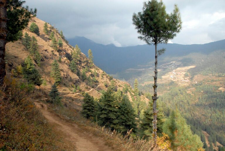
What the notice does not spell out is that the old approach is gone. Syabrubesi is still cut off by road, so the Langtang trail now starts at Dhunche and climbs over the shoulder of the valley through Thulo Bharkhu, Sano Bharkhu, Brabal and Thulo Syaphru before rejoining the classic path at Bamboo. The Annapurna Express reported the reopened route on 29 October, quoting Dindu Jyangba Tamang, ward chair of Gosaikunda-4: “Though the disaster had damaged trekking routes, we have now made alternative routes safe. Tea Houses, hotels and local entrepreneurs are fully prepared to welcome tourists in Langtang valley.”
In practice the reroute costs a day. The lake is still reached from Dhunche by way of Sing Gompa, Chandanbari and Lauribina, but anyone linking Gosaikunda with Langtang now walks a corridor that was, until October, a landslide zone patched by voluntary labour.
The advisory that was never cancelled
On 27 August, with the Dhunche road destroyed, the Ministry of Culture, Tourism and Civil Aviation advised pilgrims and trekkers leaving Gosaikunda to return to Kathmandu by an alternative line – over the Suryakunda pass and down through Ghoptebhir, Ghyangphedi, Samundratar and Tokha – rather than descending towards Dhunche.
That instruction made sense when the road was in the river. What is less clear is whether it has been formally lifted. We could not find a published notice withdrawing it, even though TAAN’s October advisory lists Dhunche as reachable by road and Gosaikunda as open. Travellers therefore face two documents pointing in different directions: one from the ministry in August, one from the trekking association in October.
That gap is not a technicality: a group that plans a Dhunche descent and then learns its agency still follows the August advisory loses a day at best. Ask before leaving Kathmandu, and get the answer in writing from the agency that holds the TIMS card.
The window is short
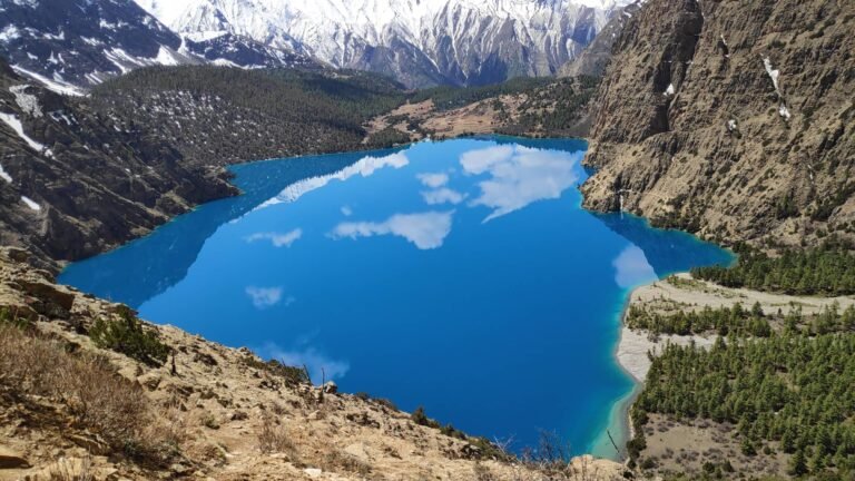
Gosaikunda sits at 4,380 metres: a 13.8-hectare lake 625 metres long and 26 metres deep, listed as a Ramsar site in September 2007. The climb to it is fast and the altitude is unforgiving. Dhunche is roughly 2,000 metres, Sing Gompa 3,330, Lauribina 3,920, and the lake another 460 metres above that. Sleeping at Sing Gompa or Lauribina instead of pushing straight through is the difference between a hard day and a rescue.
Weather is now the binding constraint. Hail and 31.2 mm of rain hit Kathmandu on Bhai Tika, and the Weather Forecasting Division has forecast light rain and snow at isolated places in the Himalaya of Koshi, Bagmati and Gandaki. Meteorologists quoted by BBC Nepali expect conditions to improve from Thursday and stay largely clear for about three days; they note too that the westerlies that drive Nepal’s winter weather do not usually become active until December.
So November is the last comfortable month. Once snow settles on Lauribina, the crossing to Helambu becomes a mountaineering decision rather than a trekking one, and the high lodges on the Gosaikunda line usually begin to shut. Anyone who wants the lake without the crowd should go in the next two or three weeks. Anyone who wants Langtang’s valley villages has the winter ahead, on a road that is patched rather than rebuilt.
What it means for travellers
- Start at Dhunche. Do not book a transfer to Syabrubesi; it is not reachable by road and the trail from it is not the way in. The current approach climbs through Thulo Bharkhu, Brabal and Thulo Syaphru.
- Sort permits first. Langtang National Park entry is Rs 3,000 for foreigners and Rs 100 for Nepalis, plus a TIMS card; both are issued at the NTB counter in Bhrikutimandap or at the Dhunche checkpost, and a licensed guide is required on these routes (full detail in our visas and permits guide). Carry cash.
- Add a day. The reroute adds walking, and the Betrawati crossing is a Bailey bridge on a highway still under repair. Do not book a tight international connection against a Dhunche return.
- Confirm the exit route. If the Dhunche road closes again, the Dupcheshwor line through Suryakunda, Ghoptebhir and Ghyangphedi is the published fallback.
- Plan for altitude, not distance. Break the climb at Sing Gompa or Lauribina, and do not cross Lauribina La on the same day you reach the lake (see our Nepal trekking safety and health guide).
- Expect thin services. Supply chains into Langtang and Gosaikunda are still recovering; lodges restock from Dhunche. Mobile data is unreliable above Chandanbari.
What it means for operators
The itinerary that sold in 2025 does not exist in 2026: a Langtang Valley trek now starts a day later, over the valley shoulder, and a Gosaikunda-Langtang link must be priced with that reroute and a buffer day. Operators should also settle the ministry-versus-TAAN question in writing, because clients will ask.
The commercial opening is the shoulder season. Ghale’s point – that Gosaikunda is becoming a year-round trekking destination rather than a two-festival pilgrimage – is the most useful thing said this week, and it is the one domestic operators can sell immediately while foreign bookings for Langtang rebuild around the spring window.
Frequently asked questions
Is the Langtang Valley trek open after the August 2026 Rasuwa flood?
Yes. The Trekking Agencies Association of Nepal (TAAN) lists Langtang Valley and Kyanjin Gompa as open in its advisory of October 22, 2026. The route is open but different from the pre-flood itinerary: you drive to Dhunche and walk in over the valley shoulder rather than starting at Syabrubesi.
Can I still start the Langtang trek from Syabrubesi?
No. Syabrubesi market and the highway towards it were largely destroyed on August 26, 2026, and the village is still not reachable by road. Do not book a transfer to Syabrubesi. The current approach starts at Dhunche and climbs through Thulo Bharkhu, Brabal and Thulo Syaphru before rejoining the classic trail at Bamboo.
Do I need a guide and permits for Langtang and Gosaikunda?
Yes. Langtang National Park entry costs Rs 3,000 for foreigners and Rs 100 for Nepalis, and a TIMS card is required. A licensed guide is required on these routes. Both permits are issued at the Nepal Tourism Board counter in Bhrikutimandap, Kathmandu, or at the Dhunche checkpost. Carry cash.
Is Gosaikunda accessible in late November?
It is open, but the window is closing. Snow on the Lauribina La turns the Helambu crossing into a mountaineering decision rather than a trekking one, and high lodges usually begin to shut as winter settles in. The next two to three weeks are the last comfortable period.
Is the Ministry of Tourism advisory of August 27, 2026 still in force?
No public notice withdrawing it could be found, even though TAAN later listed Dhunche as reachable by road. Travellers should ask their agency to confirm the current exit route in writing before departure, because the two documents point in different directions.
Sources
- The Kathmandu Post, “Oft-battered Langtang Valley cut off after Rasuwa floods”, September 2, 2026. kathmandupost.com
- The Annapurna Express, report on the reopened Langtang route quoting Dindu Jyangba Tamang, ward chair of Gosaikunda-4, October 29, 2026. theannapurnaexpress.com
- MyRepublica / Nagarik Network, “Langtang Valley trek reopens”, 2026. myrepublica.nagariknetwork.com
- MyRepublica / Nagarik Network, “Langtang, Gosainkunda trekking routes open to visitors”, 2026. myrepublica.nagariknetwork.com
- Online Khabar (English), “Langtang and Manaslu trekking routes reopen, TAAN issues safety advisory”, October 2026. english.onlinekhabar.com
- People’s Review, “Langtang and Gosaikunda routes open for trekking”, October 23, 2026. peoplesreview.com.np
- Wikipedia, “2026 Nepal-Tibet floods” (background). en.wikipedia.org
- TAAN trekking advisory on reopened routes (22 October 2026) and the Ministry of Culture, Tourism and Civil Aviation advisory on Gosaikunda returns (27 August 2026); Department of Hydrology and Meteorology forecast, via cited outlets.
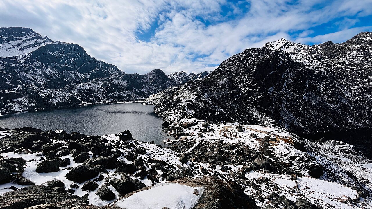
Featured image: Gosaikunda in snowfall. Photo: Nishan Pandit / Wikimedia Commons, CC BY-SA 4.0.
Related guides on TravellingNepal.com
Share this content: