Prithvi Highway Landslide Blocks Traffic in Tanahun: What Travelers to Pokhara and Annapurna Need to Know
Complete guide: Nepal Trekking Safety and Health Guide (2026)
Damauli (Tanahun), August 24, 2026 — A landslide on the Prithvi Highway in Byas Municipality-12 of Tanahun district has disrupted vehicular movement on Nepal’s most important tourist road, affecting travel between Kathmandu and Pokhara. Police confirmed that one lane of the highway was blocked on Sunday evening, bringing one-way traffic to a standstill in the affected section.
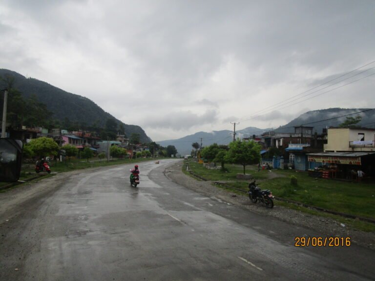
The Prithvi Highway — the 174-kilometre arterial road connecting Kathmandu to Pokhara via Dhading, Chitwan, Tanahun, and Kaski districts — is the primary overland route for trekkers heading to the Annapurna region, sightseers traveling to lakeside Pokhara, and pilgrims visiting Manakamana Temple near Mugling. The landslide occurred in the Tanahun section, roughly midway between Kathmandu and Pokhara.
Table of Contents
- What Happened: The Landslide at Byas Municipality-12
- Where Exactly Is the Blockage?
- Why This Matters for Tourists and Trekkers
- The Prithvi Highway: Nepal’s Most Critical Tourist Road
- Monsoon Landslides on Nepal’s Highways: A Recurring Pattern
- Current Road Status and Clearance Efforts
- Travel Advice for Tourists and Trekkers (August 2026)
- Alternative Routes and Transportation Options
- Safety Tips for Monsoon Road Travel in Nepal
- Key Takeaways
- FAQ: Prithvi Highway Landslide and Travel Disruptions
- Sources and References
What Happened: The Landslide at Byas Municipality-12
According to a report published on August 24, 2026, by Online Khabar (English edition), citing the government-run RSS news service, a landslide struck the Prithvi Highway in Byas Municipality-12, Tanahun district, on Sunday evening (August 23). The landslide debris covered one lane of the road, reducing the highway to a single-lane passage and creating significant delays for vehicles traveling in both directions.
DSP Dwarika Prasad Ghimire, from the District Police Office, Tanahun, confirmed that a team of 15 personnel — including traffic police — was deployed to the site immediately after the landslide was reported. The team is working to clear the debris and restore full two-lane traffic. However, as of the time of reporting, the road remained partially blocked, and police issued an advisory urging drivers to exercise caution while passing through the affected section.
The landslide is the latest in a series of monsoon-related road disruptions across Nepal in August 2026. Earlier this month, the Tokha-Chhahare road was closed at night due to landslide risk on the Nepal-China border route in Nuwakot, and the BP Highway was blocked after rains swept away diversions in Kavre, affecting trekkers traveling to Manthali and Lukla for Everest region treks.
Where Exactly Is the Blockage?
The landslide occurred in Byas Municipality-12, Tanahun district, which lies along the central stretch of the Prithvi Highway between Mugling and Damauli. This section is approximately 100–120 kilometres from Kathmandu and about 60–80 kilometres from Pokhara, placing it roughly at the midpoint of the 174 km journey.
Tanahun is one of five districts the Prithvi Highway passes through — the others being Kathmandu, Dhading, Chitwan, and Kaski. The highway’s route follows a series of deep river valleys, and the terrain in Tanahun is particularly prone to landslides during the monsoon season due to its steep hillsides and fractured rock formations. The nearby Krishna Bhir cliff in Dhading district, approximately 83 km from Kathmandu, has historically been one of the most landslide-prone sections of the entire highway.
| Location Detail | Information |
|---|---|
| District | Tanahun |
| Municipality | Byas Municipality-12 |
| Highway | Prithvi Highway (NH17) |
| Date of Landslide | August 23, 2026 (Sunday evening) |
| Reported | August 24, 2026 |
| Impact | One lane blocked; one-way traffic |
| Clearance Team | 15 personnel led by DSP Dwarika Prasad Ghimire |
| Distance from Kathmandu | ~100–120 km |
| Distance from Pokhara | ~60–80 km |
Why This Matters for Tourists and Trekkers
The Prithvi Highway is not just any road — it is the primary overland route from Kathmandu to Pokhara, the gateway city for Annapurna trekking. Every year, hundreds of thousands of tourists travel this highway: trekkers heading to Annapurna Base Camp, Annapurna Circuit, Poon Hill, Mardi Himal, and Upper Mustang; sightseers visiting Phewa Lake and the lakeside town of Pokhara; and pilgrims traveling to Manakamana Temple (accessible via cable car near Mugling) and Muktinath.
The Pokhara travel guide for 2026 notes that most international visitors reach Pokhara either by a 25-minute flight from Kathmandu or by a 6–7 hour tourist bus journey along the Prithvi Highway. When a landslide blocks even one lane of this highway, the ripple effects are significant:
- Tourist bus delays: The popular tourist buses that depart Kathmandu at 7:00 AM for Pokhara can face delays of several hours, arriving late in the evening instead of mid-afternoon.
- Trekker itinerary disruptions: Trekkers with fixed schedules may miss pre-booked lodge accommodations or guide meeting times in Pokhara or trailheads like Birethanti, Nayapul, or Ghandruk.
- Flight connection risks: Travelers connecting from Pokhara to Jomsom (for Upper Mustang or Muktinath) or taking helicopter flights to Annapurna Sanctuary may miss their scheduled departures.
- Supply chain impacts: Goods and fuel transported to Pokhara and beyond can be delayed, affecting lodge operations and food availability on trekking routes.
For trekkers specifically, the Prithvi Highway connects to the road that leads to Besisahar (the starting point of the Annapurna Circuit) and to Pokhara (the hub for ABC, Poon Hill, and Mardi Himal treks). Any disruption on this highway directly affects Annapurna-bound travelers. The Annapurna region treks complete guide provides detailed route information for all these trails.
The Prithvi Highway: Nepal’s Most Critical Tourist Road
The Prithvi Highway, also designated as NH17 (formerly H04), is a 174-kilometre (108-mile) highway connecting Naubise on the Tribhuvan Highway — 26 km from Kathmandu — to Prithvi Chowk in Pokhara. Construction began in 1967 with Chinese government assistance and was completed in 1974. The highway is named after King Prithvi Narayan Shah, the founder of modern Nepal.
Until the opening of the B.P. Koirala Highway in 2011, the Prithvi Highway was the only improved land route from Kathmandu Valley to all points south and west, making it the main artery for heavy trucks into Kathmandu and the primary route to Pokhara. Even today, it remains the busiest and most important highway for tourist traffic to the Annapurna region.
The highway passes through five districts — Kathmandu, Dhading, Chitwan, Tanahun, and Kaski — and features a junction with the Tribhuvan Highway at Naubise, a connection to the Mahendra Highway (Nepal’s longest highway) via the Bharatpur-Mugling section, and a link to Nuwakot District via a road at Galchhi. The scenery along the highway is dramatic, following deep river valleys, and on clear days, travelers can see Machapuchare and the Annapurna massif from the road.
However, the highway has a well-documented vulnerability to landslides. Wikipedia notes that it is described as “landslide-prone and heavily congested,” with the Krishna Bhir cliff in Dhading being one of the most notorious sections. Major bridges near Mahadevbesi, Belkhu, and Malekhu were washed out by floods in 1993, and the 370-metre bridge over the Madi River at Damauli (near the current landslide site) has been flagged for foundation weakness due to nearby sand and rock extraction.
Monsoon Landslides on Nepal’s Highways: A Recurring Pattern
Nepal’s monsoon season runs from June to September, bringing heavy rainfall that triggers landslides across the country’s hill and mountain regions. The combination of steep terrain, fractured geology, intense rainfall, and in some areas, road construction that destabilizes hillsides, makes Nepal one of the most landslide-affected countries in the world.
The Prithvi Highway is particularly vulnerable because it follows river valleys through the middle hills, where the terrain is steep and the rock is often fractured. Key landslide-prone sections include:
- Krishna Bhir (Dhading): A cliff section approximately 83 km from Kathmandu, historically the most landslide-prone part of the highway.
- Jogimara area (Dhading): Another section affected by landslides since the highway first opened.
- Mugling-Narayanghat section: The connection to the Mahendra Highway, prone to flooding and landslides during heavy rains.
- Tanahun section: Where the current August 2026 landslide occurred, near Damauli and the Madi River bridge.
This is not an isolated event. In August 2026 alone, multiple road disruptions have been reported across Nepal:
- The Tokha-Chhahare road in Nuwakot was closed at night due to landslide risk.
- The BP Highway in Kavre was blocked after rains swept away diversions.
- The Ghandruk road was affected by Modi River flooding, washing away restaurants at Syauli Bazaar.
- The Banke National Park highway section saw revised time-card rules for travel on the Mahendra Highway.
These incidents underscore a broader pattern: during the monsoon months, Nepal’s highway network faces frequent disruptions that can affect tourist itineraries. Travelers should always check current road conditions before embarking on long overland journeys, especially between June and September.
Current Road Status and Clearance Efforts
As of August 24, 2026: The landslide on the Prithvi Highway at Byas Municipality-12, Tanahun, has partially blocked one lane of traffic. A 15-person team led by DSP Dwarika Prasad Ghimire from the District Police Office, Tanahun, has been deployed to clear the debris. The police team is taking steps to remove the landslide material and bring the road back to full operation.
Police have advised drivers to exercise caution while passing through the affected section. One-way traffic is in effect, meaning vehicles may need to wait for oncoming traffic to clear before proceeding through the single open lane. This can cause significant delays, particularly during peak travel hours when tourist buses and freight trucks share the road.
Note: Road conditions in Nepal can change rapidly during monsoon season. New landslides can occur without warning, and cleared sections can be re-blocked by subsequent rainfall. Always verify the latest conditions before traveling.
Travel Advice for Tourists and Trekkers (August 2026)
If you are planning to travel from Kathmandu to Pokhara or the Annapurna region in the coming days, here is what you should know:
1. Check Current Road Conditions Before Departure
Before boarding a bus or hiring a private vehicle, check with your hotel, travel agency, or local news outlets for the latest road conditions. The District Police Office in Tanahun and the Traffic Police helpline can provide real-time updates on the Prithvi Highway status.
2. Consider Flying Instead of Taking the Bus
If your schedule is tight, consider booking a flight from Kathmandu to Pokhara. Several airlines operate daily flights on this route, including Buddha Air, Yeti Airlines, and Shree Airlines. The flight takes approximately 25 minutes compared to the 6–7 hour bus journey. While flights are more expensive (approximately USD 100–120 vs. USD 15–25 for a tourist bus), they eliminate the risk of landslide delays entirely.
Notably, Buddha Air has also resumed Nepalgunj-Pokhara flights from September 2026, expanding flight options for travelers heading to western Nepal.
3. Allow Extra Travel Time
If you must travel by road, build in extra buffer time. A journey that normally takes 6–7 hours may take 8–10 hours or more due to landslide-related delays. Do not book connecting flights, trekking permits appointments, or guide meetings on the same day as your bus journey.
4. Carry Essential Supplies
When traveling by road during monsoon, carry water, snacks, and a power bank. Delays of several hours are not uncommon, and roadside facilities may be limited in the affected sections. A first-aid kit and any personal medications are also advisable.
5. Keep Your Trekking Agency Informed
If you have booked a trek through an agency, inform them of any travel delays. Most agencies are familiar with monsoon disruptions and can adjust your itinerary, reschedule guide meetings, or arrange alternative transportation if needed.
Alternative Routes and Transportation Options
If the Prithvi Highway remains partially blocked, travelers have several alternatives:
| Option | Route | Duration | Approximate Cost | Notes |
|---|---|---|---|---|
| Domestic Flight | Kathmandu → Pokhara (direct) | 25 minutes | USD 100–120 | Fastest and safest option; weather-dependent |
| Tourist Bus (via Prithvi Highway) | Kathmandu → Pokhara | 6–10 hours (with delays) | USD 15–25 | Most common; subject to landslide delays |
| Local Bus (via Prithvi Highway) | Kathmandu → Pokhara | 7–12 hours | USD 8–12 | Cheaper but less comfortable; more stops |
| Private Jeep/Hire | Kathmandu → Pokhara | 5–9 hours | USD 120–200 | Flexible timing; can take detours if needed |
| Tribhuvan Highway → B.P. Koirala Highway | Longer southern route | 10–12 hours | Varies | Detour option if Prithvi is fully blocked; much longer |
For trekkers heading to the Annapurna Circuit via Besisahar, the Prithvi Highway connects to the road north at Mugling or Dumre. If the Tanahun section is blocked, the detour via the Tribhuvan Highway and B.P. Koirala Highway adds significant time and is generally not recommended unless the Prithvi Highway is completely impassable.
Safety Tips for Monsoon Road Travel in Nepal
Traveling on Nepal’s highways during the monsoon season (June–September) requires extra caution. Here are essential safety tips for tourists and trekkers:
- Travel during daylight hours. Landslides are more likely after heavy rainfall, which often occurs in the afternoon and evening. Traveling in the morning reduces (but does not eliminate) the risk of encountering a fresh landslide.
- Do not travel at night. Night travel on Nepal’s hill roads is dangerous even in good weather. Reduced visibility, lack of guardrails, and the inability to spot landslide debris make night travel inadvisable. The Tokha-Chhahare road, for example, was specifically closed at night due to landslide risk.
- Monitor weather forecasts. Check weather apps and local news before departure. If heavy rain is forecast for the day, consider postponing non-essential travel.
- Stay informed about road conditions. Follow local news outlets (Kathmandu Post, Online Khabar, The Himalayan Times) and check with your hotel or travel agency for the latest road status. The Nepal Traffic Police also provides updates via their social media channels.
- Choose reputable bus companies. Tourist bus companies like Greenline, Swiss Travel, and Golden Travel have experienced drivers who are familiar with the highway’s hazards. Avoid the cheapest local buses, which may have poorly maintained vehicles and less experienced drivers.
- Keep emergency contacts handy. Save the numbers for your embassy, travel insurance emergency line, trekking agency, and the Tourist Police (dial 1144 or +977-1-4215172 in Nepal). The Tourist Police can assist with travel emergencies and provide road condition information.
- Have a backup plan. If road travel is disrupted, know your alternatives — flight schedules, alternative routes, or adjusting your itinerary by a day. Flexibility is key during monsoon travel in Nepal.
- Carry travel insurance that covers trip delays. Comprehensive travel insurance can cover additional accommodation and meal costs if you are delayed, as well as emergency evacuation if needed. See the Nepal Trekking Safety and Health Guide for insurance recommendations.
Key Takeaways
- A landslide blocked one lane of the Prithvi Highway in Byas Municipality-12, Tanahun, on August 23, 2026, affecting travel between Kathmandu and Pokhara.
- A 15-person police team led by DSP Dwarika Prasad Ghimire is clearing the debris; one-way traffic is in effect.
- The Prithvi Highway is the primary route from Kathmandu to Pokhara and the Annapurna trekking region — disruptions affect thousands of tourists.
- Monsoon season (June–September) is peak landslide season in Nepal; multiple road closures have occurred in August 2026.
- Consider flying Kathmandu–Pokhara (25 min, ~USD 100–120) to avoid road delays if your schedule is tight.
- Always check current road conditions before departure and allow extra travel time during monsoon.
- Carry emergency supplies and keep the Tourist Police hotline (1144) saved in your phone.
FAQ: Prithvi Highway Landslide and Travel Disruptions
Is the Prithvi Highway completely closed due to the landslide?
As of August 24, 2026, the highway is not completely closed. One lane is blocked by landslide debris, and one-way traffic is in effect. Vehicles can still pass through the affected section in Byas Municipality-12, Tanahun, but significant delays are expected. A police team is working to clear the debris and restore full two-lane traffic.
How long will it take to clear the landslide?
The District Police Office, Tanahun, has deployed a 15-person team to clear the debris. The exact timeline depends on the volume of landslide material and weather conditions. Minor landslides are often cleared within hours, but larger ones can take a day or more. Check with local news or the Traffic Police for the latest updates.
Should I cancel my bus trip from Kathmandu to Pokhara?
You do not necessarily need to cancel your trip, but you should allow extra travel time (potentially 8–10 hours instead of the usual 6–7) and check the latest road conditions before departure. If you have a tight schedule or connecting flights, consider booking a domestic flight instead.
What is the best way to get from Kathmandu to Pokhara during monsoon?
Flying is the safest and most reliable option during monsoon season. Several airlines operate daily 25-minute flights from Kathmandu to Pokhara. While more expensive than bus travel, flights eliminate the risk of landslide delays. If you prefer to travel by road, choose a reputable tourist bus company and travel in the morning.
Are there alternative roads to Pokhara if the Prithvi Highway is blocked?
The main alternative is the Tribhuvan Highway south to the B.P. Koirala Highway, which provides a longer southern route. However, this detour adds several hours to the journey and is generally only used if the Prithvi Highway is completely impassable. For most situations where one lane is open with delays, waiting for the traffic to clear is faster than taking the detour.
Is it safe to travel on Nepal’s highways during the monsoon?
Travel on Nepal’s hill roads during monsoon (June–September) carries inherent risks due to landslides and flooding. However, thousands of travelers do so safely each year by following basic precautions: traveling during daylight, using reputable transport, checking road conditions, and maintaining schedule flexibility. Always carry travel insurance that covers trip delays and emergency evacuation.
How does this landslide affect Annapurna trekking plans?
If you are traveling to Pokhara by road to start an Annapurna trek, you may experience delays reaching Pokhara or your trailhead. Most trekking itineraries have flexibility built in, and a one-day delay is usually manageable. Inform your trekking agency of any delays so they can adjust arrangements. If you have a fixed-date trekking permit or limited time, consider flying to Pokhara to avoid road delays.
Where can I get real-time road condition updates in Nepal?
Check local news outlets (Online Khabar, Kathmandu Post, The Himalayan Times), contact the Nepal Traffic Police, ask at your hotel or guesthouse, or call the Tourist Police at 1144 (or +977-1-4215172). Your trekking agency or travel operator can also provide current road status information.
Sources and References
- Online Khabar (English): “Landslide affects vehicular movement on Prithvi Highway,” August 24, 2026 (via RSS, the government-run national news portal of Nepal).
- Wikipedia: Prithvi Highway — background on the highway’s route, history, and landslide vulnerability.
- Wikipedia: Geography of Nepal — monsoon season context (June–September wet season).
- Nepal Tourism Board: Safety in the Mountains — official safety guidance for travelers.
Article published on August 24, 2026. Road conditions in Nepal can change rapidly during monsoon season. Always verify current conditions before traveling. This article will be updated as new information becomes available.

Share this content: