Bhotekoshi Flood Damage: Nepal Tallies Rs400 Billion Loss
Route alert: Update 15 September 2026: the NDRRMA has now published its Rapid Damage and Needs Assessment, putting recovery costs at USD 4.7 billion, and the infrastructure ministry has set an end-of-Asoj (mid-October) target for restoring flood-damaged roads. Read the latest: Nepal Targets Mid-October for Flood Road Recovery.
Quick answer (as of Sunday, 6 September 2026): Nepal has begun the official accounting of the 26 August Bhotekoshi–Trishuli flash flood, and the preliminary number is stark. A Rapid Damage and Needs Assessment (RDNA) prepared under the National Planning Commission puts total damage and loss at around Rs400 billion, while a fuller Post Disaster Needs Assessment (PDNA) — ordered by the government with a six-week deadline — will settle the final figure that an international donor conference will be asked to fund. The early tally that matters to travellers: 7,570 houses damaged, 55 kilometres of roads and 37 motorable bridges hit, 13 hydropower projects knocked offline, and 1,344 bodies recovered with around 5,000 people — including roughly 600 foreigners from 35 countries — still missing.

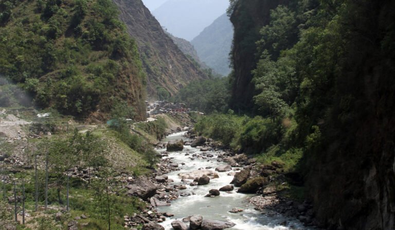
The flood of 26 August — which the Kathmandu Post has described as Nepal’s worst disaster in a decade — tore through the Bhotekoshi river basin from the Tibet border down into the Trishuli valley, erasing settlements, burying hydropower tunnels and cutting road corridors that trekkers, rafters and overland travellers use every day. Eleven days on, the search for the missing continues; on Saturday, rescue teams pulled a 64-year-old woman alive from a buried house in Betrawati and a Chinese worker from 225 metres inside a flooded tunnel at the Upper Trishuli-I project, as we reported in our day-11 rescue update.
But alongside the rescue effort, a second process has now started: the arithmetic of recovery. Its numbers — houses, bridges, megawatts, missing foreigners — will shape how quickly the trekking gateways, highways and rafting runs of central Nepal get back on their feet.
Key Takeaways
- Nepal’s preliminary Rapid Damage and Needs Assessment (RDNA) puts total flood damage at around Rs400 billion; the full PDNA, due within six weeks, could revise that figure by 20–30 percent in either direction.
- A committee led by National Planning Commission vice-chair Gunakhar Bhatta must deliver the PDNA within six weeks; a donor conference will follow to raise reconstruction funds.
- The damage tally includes 7,570 houses (affecting around 32,933 people), 48 government offices, 55 km of roads, 37 motorable bridges, 68 suspension bridges, 1,806 hectares of farmland and 13 hydropower projects — with 783 MW of generation capacity affected.
- As of Saturday, 1,344 bodies had been recovered; around 5,000 people remain missing, including approximately 600 foreigners from 35 countries.
- The UNDP estimates 84,270 people affected across 17 municipalities in six districts: Rasuwa, Nuwakot, Dhading, Chitwan, Gorkha and Tanahu.
- Early recovery — deemed essential within six months — is budgeted at Rs8 billion in the RDNA.
Table of Contents
- What the Official Tally Says: Rs400 Billion and Counting
- From RDNA to PDNA: How the Recovery Money Flows
- The Human Toll: Where the Damage Is Concentrated
- Roads, Bridges and 783 Megawatts: The Infrastructure Bill
- The River at the Centre: Background for Travellers
- What It Means for the Autumn Trekking and Travel Season
- Frequently Asked Questions
- Sources
What the Official Tally Says: Rs400 Billion and Counting
The first consolidated figure comes from the RDNA, prepared by the National Disaster Risk Reduction and Management Authority (NDRRMA) with support from the National Planning Commission. Arjun Bhandari, who led the RDNA preparation, told the Kathmandu Post that the report was in its final stage of publication, with data being updated for release by Sunday evening. The Ministry of Foreign Affairs released a partial version of the report on Saturday.
That partial report carries the numbers that will define the reconstruction debate. Here is the confirmed damage picture as published so far:
| Damage category | Confirmed figure (RDNA, preliminary) |
|---|---|
| Total estimated loss and damage | ~Rs400 billion (final PDNA may vary 20–30%) |
| Houses damaged | 7,570 (affecting ~32,933 people) |
| Government offices impacted | 48 |
| Roads damaged | 55 km |
| Motorable bridges damaged | 37 |
| Suspension bridges damaged | 68 |
| Agricultural land affected | 1,806 hectares |
| Hydropower projects damaged | 13 (plus 1 solar plant, 2 transmission lines) — 783 MW affected |
| Early recovery needs (6 months) | Rs8 billion |
Bhandari cautioned that the final PDNA could find a variation of around 20 to 30 percent against the Rs400 billion RDNA figure — a reminder that these are early, actively updated estimates rather than a closed account. The RDNA also stresses that early recovery work is essential within six months, at a cost of roughly Rs8 billion, before the slower business of rebuilding houses, bridges and power plants begins.
From RDNA to PDNA: How the Recovery Money Flows
For travellers watching Nepal’s recovery, the alphabet soup matters, because it determines the pace of reconstruction on the roads and trails you will use.
An RDNA — Rapid Damage and Needs Assessment — is the fast, first-pass estimate of what broke and what it will cost. A PDNA — Post Disaster Needs Assessment — is the deeper, slower instrument: a single consolidated report on the physical impacts of a disaster, the economic value of the damage and losses, the human impacts as experienced by affected communities, and the resulting early and long-term recovery needs. It is on the basis of the PDNA that the government will organise a donor conference to raise funds for reconstruction, rehabilitation, rebuilding of private and public properties, and infrastructure construction.
The PDNA committee is led by Gunakhar Bhatta, vice-president of the National Planning Commission, and has been entrusted with completing the report within six weeks. “We have already started groundwork for preparing the report, having been entrusted to complete the report within six weeks,” Bhatta told the Post. “By creating seven clusters, we are analysing the data from the Rapid Damage and Needs Assessment.”
Those seven clusters cover infrastructure; social sectors such as health and education; climate change; production; agriculture; and the overall economic sectors. The committee plans to lean on technology and local governments for data: local units in the affected districts hold the records of public-sector losses, while the private sector — mostly houses, banks and hotels — absorbed some of the heaviest damage and must be surveyed separately.
The practical takeaway: within roughly six weeks (by mid-October, the height of the autumn trekking season), Nepal will have an official reconstruction price tag and a donor conference agenda. The speed at which pledged money converts into rebuilt bridges and reopened roads is the variable that will decide the 2027 spring season for the Langtang and Ganja La corridors.
The Human Toll: Where the Damage Is Concentrated
According to the United Nations Development Programme, the estimated affected population is 84,270 people across 17 municipalities in six districts: Rasuwa, Nuwakot, Dhading, Chitawan, Gorkha and Tanahu. The suffering is not evenly spread — it clusters in a handful of riverine municipalities:
| Municipality (District) | Estimated affected population | Share of total |
|---|---|---|
| Bidur (Nuwakot) | 25,354 | 30.1% |
| Benighat Rorang (Dhading) | 11,313 | 13.4% |
| Gajuri (Dhading) | 7,991 | 9.5% |
Bidur, the headquarters of Nuwakot district, sits on the Trishuli and absorbed the single largest share of human impact. Benighat Rorang and Gajuri, both in Dhading, lie on the Prithvi Highway corridor — the main road most trekkers ride between Kathmandu and Pokhara. If you have driven to Annapurna trailheads, you have passed through this landscape.
The building stock tells the same story in miniature. Of 2,359 buildings assessed so far, the UNDP reports 1,890 classified as destroyed, 187 as damaged, and 282 as possibly damaged. Preliminary modelling estimates $158.6 million in potential building damage, with an uncertainty range of 30 percent, and approximately $170 million in potential damage to residential and commercial buildings along the Rasuwa and Nuwakot river valleys.
The missing-persons figure is the one that keeps this disaster on the world’s front pages. Around 5,000 people remain unaccounted for — among them approximately 600 foreigners from 35 countries, many of them workers at the hydropower projects that line the Trishuli and its tributaries. As of Saturday, 1,344 bodies had been recovered. Saturday’s two live rescues — an elderly woman found under her collapsed house and a Chinese tunnel worker — explain why officials refuse to call off any search: as tunnel expert Arnold Dix, who arrived in Nepal on Saturday to assist, has said, people can survive underground far longer than expected.
Roads, Bridges and 783 Megawatts: The Infrastructure Bill
For a travel-news audience, three numbers in the RDNA matter more than the rest.
55 kilometres of roads. The damaged network includes sections of the corridors that connect Kathmandu to the Langtang trailhead at Syabrubesi and that carry rafting traffic along the Trishuli. Our earlier coverage explains how the flood’s aftermath has already closed the Prithvi Highway at Krishnabhir — a reminder that a single slope failure can sever the country’s busiest tourist road link for days.
105 bridges (37 motorable + 68 suspension). Suspension bridges are the unglamorous arteries of Nepal’s trekking network — in Rasuwa and Nuwakot they link villages to schools, health posts and trails, including approach routes on the Gosaikunda pilgrimage trail. Replacing 68 of them is not a matter of months.
783 megawatts of affected hydropower capacity across 13 damaged projects, one solar plant and two transmission lines. That is generation the national grid will miss during reconstruction — and it explains why power supply in central Nepal may stay irregular even as hotels reopen.
Add the private-sector damage — mostly houses, banks and hotels, in Bhatta’s words — and the recovery challenge comes into focus: the tourism infrastructure of the Trishuli corridor (lodge beds, river camps, road access) sits directly inside the damaged zone.
The River at the Centre: Background for Travellers
The Trishuli is not an anonymous waterway. It is formed by the merger of the Kerung Khola (Gyirong Tsangpo) and the Lende Khola (Donglin Tsangpo), which originate in Gyirong County of Tibet and join near Rasuwa Gadhi on the Nepal–Tibet border. Its valley was historically the trade route between the Kathmandu Valley and Tibet — the same corridor that today carries the Trishuli’s famous rafting runs and the road toward the Langtang and Ganja La treks.
The flood zone also brushes one of Nepal’s conservation crown jewels. Langtang National Park — established in 1976 as Nepal’s first Himalayan national park — covers 1,710 square kilometres across Nuwakot, Rasuwa and Sindhupalchok districts, with its eastern and western boundaries following the Bhote Koshi and the Trishuli rivers respectively. The park contains the Langtang valley and the sacred Gosaikunda lakes at 4,300 metres. Rasuwa’s district headquarters, Dhunche, is the administrative gateway to that park; Nuwakot’s headquarters, Bidur, anchors the worst-affected municipality in the country. (These background facts are drawn from Wikipedia’s consistently sourced pages on the river, park and districts, and cross-checked against our earlier coverage.)
In other words: the RDNA’s line items are not abstractions. They are the trailhead district of Langtang, the rafting river of central Nepal, and the highway corridor to Pokhara.
What It Means for the Autumn Trekking and Travel Season
September to November is peak season in Nepal — the months when the monsoon clears, the skies open, and the majority of the year’s trekkers arrive. The disaster’s timing could not have been worse for the affected districts, and travellers planning autumn trips should read the recovery plan with three practical points in mind.
1. The Langtang corridor is inside the damaged zone. Rasuwa — the district that holds Syabrubesi, Dhunche and the Langtang trailhead — is among the six affected districts, and around 1,000 people remain missing across its hydropower projects alone, as we detailed in our Rasuwa flood rescue update. No reopening date for the trekking corridor has been announced. If Langtang is on your list for this autumn, treat it as unconfirmed until official notice, and check with the Nepal Tourism Board and your operator before committing.
2. Everest and Annapurna base-camp traffic uses different corridors — but the approach roads matter. The classic Everest and Annapurna trailheads are outside the six affected districts, but overland travellers to Pokhara ride the Prithvi Highway through Dhading, where Gajuri and Benighat Rorang — over 19,000 affected people between them — sit directly on the route. Expect slower journeys, possible night closures and ongoing landslide repair at known weak points such as Krishnabhir.
3. The six-week PDNA clock is your best forecast. When the Bhatta committee reports by mid-October, watch two things: the final damage figure (the size of the donor ask) and the sequencing of the Rs8 billion early-recovery tranche (roads, bridges and schools first, per the cluster structure). Those two announcements will tell you more about spring 2027 access to Rasuwa and Nuwakot than any rumour on social media.
For general preparedness — insurance, evacuation cover, monsoon-season road sense — our complete trekking safety and health guide remains the best starting point. And as recovery coverage continues, this article will be updated.
Frequently Asked Questions
How much damage did the August 2026 Bhotekoshi flood cause?
Nepal’s preliminary Rapid Damage and Needs Assessment estimates total loss and damage at around Rs400 billion. The full Post Disaster Needs Assessment, due within six weeks, could revise that figure by 20 to 30 percent in either direction.
What is a PDNA and why does it take six weeks?
A Post Disaster Needs Assessment consolidates the physical impacts, economic value of damage and losses, human impacts and recovery needs of a disaster into one official report. The Bhatta-led committee must finish it within six weeks because the government will use it to organise a donor conference for reconstruction funding — and the seven assessment clusters (infrastructure, health and education, climate change, production, agriculture and the economy) each require field data from affected local governments.
How many people are still missing from the Nepal floods?
As of Saturday 5 September 2026, around 5,000 people remained missing, including approximately 600 foreigners from 35 countries, many of them hydropower workers in Rasuwa. A total of 1,344 bodies had been recovered.
Is the Langtang trek open after the flood?
No reopening has been announced for the Langtang corridor, whose gateway district Rasuwa is inside the affected zone. The rescue operation remains active, and road and bridge damage is extensive. Treat any Langtang itinerary for autumn 2026 as unconfirmed until official notice, and check current advisories with the Nepal Tourism Board, TIMS/permit offices or a licensed operator before travelling.
Does the flood affect treks to Everest Base Camp or Annapurna?
The trailheads and parks themselves lie outside the six affected districts. The main impact for those treks is on the approach: the Prithvi Highway corridor through Dhading carries most Kathmandu–Pokhara road traffic and suffered heavy municipal damage and ongoing landslide repairs, so journeys may take longer than usual.
Sources
- Kathmandu Post — “Panel formed to conduct PNDA has six weeks to prepare report” (5 September 2026) — primary source for all RDNA/PDNA figures, damage tally and official quotes.
- Kathmandu Post — “Late rescues renew hope for survivors in deadly Nepal floods” (5 September 2026) — day-11 rescues, missing-persons context, “worst disaster in a decade” characterisation.
- Wikipedia — Trishuli River, Langtang National Park, Rasuwa District, Nuwakot District — background facts (river formation, park history, district geography), cross-checked against prior coverage.
Published: Sunday, 6 September 2026 (NPT). Figures are preliminary and will be updated when the full RDNA and PDNA are released.
Share this content: