Ghoptebhir Landslide Shuts Prithvi Highway for Hours, and the Slope Above It Is Still Uncut
KATHMANDU, November 9, 2026 (23 Kartik 2083) — The Prithvi Highway was closed in both directions for several hours on Sunday after a dry landslide came off the hillside at Ghoptebhir in Ichchhakamana Rural Municipality-4, Chitwan, stranding vehicles on the main overland route between Kathmandu and Pokhara. Two-way traffic resumed at 2:15pm, the District Police Office in Chitwan said, after debris was cleared from the carriageway.
The closure itself was brief. What matters for anyone travelling that road this winter is the reason it happened: the slide came off an uncut slope roughly 35 metres above the carriageway, in a stretch the road project already treats as fragile. Officials who cleared the debris said the hillside has not been stabilised, and the road project says another slide at the same spot cannot be ruled out.
- Where: Ghoptebhir, Ichchhakamana Rural Municipality-4, Chitwan, on the Mugling–Narayangadh stretch of the Prithvi Highway.
- What: A dry landslide — rock, soil and debris without rain — blocked the road in both directions on Sunday.
- Status: One-way traffic from around noon; both lanes open from 2:15pm. Stranded vehicles were cleared.
- Why it happened: Debris fell from about 35 metres above the road. The slope had not been cut; the road project says the area is geologically weak.
- Outlook: No stabilisation work has been announced, and further slides remain possible.
How the closure unfolded
Reports differ on the hour the slope failed. The Annapurna Express, quoting the chief of District Traffic Police in Chitwan, Anil Thapa, reported that vehicular movement was disrupted at 10am. A second report by the same outlet, citing the Chitwan District Police Office, said the landslide came down from the hillside above the road at around 5am. Onlinekhabar described it simply as a Sunday-morning slide. The reports do not agree on a precise time, and the exact hour is not the important part of the story — the pattern is.
By noon the road was open to alternating one-way traffic. By 2:15pm both lanes were clear. Superintendent of Police Rameshwar Poudel, chief of the District Police Office, Chitwan, said vehicles that had been queued along the highway were able to continue to their destinations once two-way movement resumed. In a country where highway closures are often measured in days, a same-day reopening is the good outcome.
It was also the expected one. While the debris was still on the road, Anil Thapa of the traffic police said that if the landslip stopped, it would not take long to restore two-way traffic. That is what happened.
The slope above the road
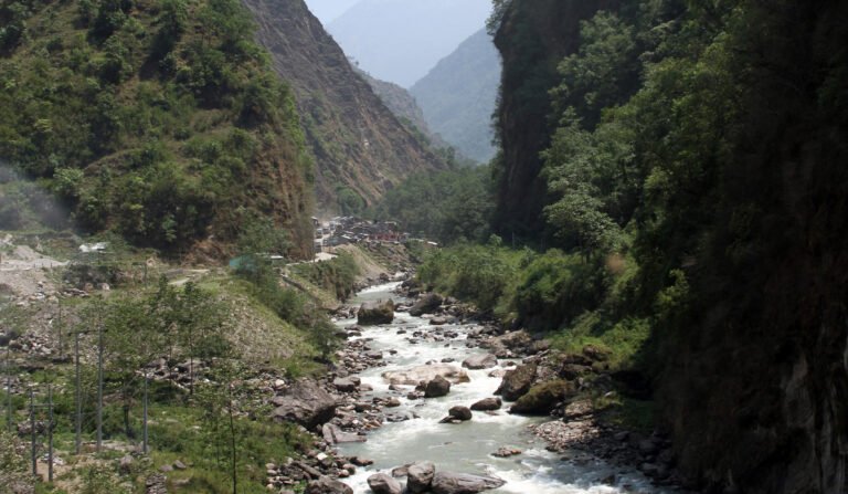
The detail worth keeping is the height the debris fell from. Sachindra Mishra, information officer for the western section of the Naubise–Mugling Road Project, said clearing the road was difficult because the dry landslide had come down from roughly 35 metres above the highway. The slope had not been cut, he said, but the landslide had occurred naturally from above. He added that the area remains geologically weak, and that the risk of further landslides persists at any time.
That is a road engineer describing a hazard that sits outside the road itself. Cutting a slope and benching it is the normal way to make a hillside safe for traffic; where the failure starts high above the cut line, the road agency has to decide whether to scale the upper slope, build a protection gallery, or accept periodic closures. None of those options has been announced for Ghoptebhir.
The same corridor, the same problem
Ghoptebhir is not an isolated failure. On September 27 this year, the Narayangadh–Muglin road reopened at 12:15pm after a mudslide blocked the Namshi Khola bridge, while eleven separate locations along the Malekhu–Muglin section of the Prithvi Highway remained obstructed by mud, rock and fallen trees. The trouble spots named that day — Shitalbazar, Krishnabhir, Jamireghat, Fishling, Dharapani — are the same names that appear every monsoon.
The scale of that September event is a reminder of how much of this road is exposed. Around 200 metres of carriageway at three locations near Fishling were covered by rock, mud and fallen trees, and about half the road had collapsed over a combined stretch of roughly 50 metres at two points in Dharapani. The Krishnabhir section, further east, had already been closed and repaired earlier in the season, with a trial run in September before traffic was allowed back.
Sunday’s slide, by contrast, happened in dry weather, weeks after the monsoon withdrew. That is the part travellers should register: landslide season on Nepal’s highways does not end when the rain does. Slopes loaded with loose material during the monsoon can fail later, under their own weight, when the ground dries and cracks or when the first winter rain soaks in.
A lake in Gorkha, and a valley still on edge
The same week brought a more serious reminder of what these slopes can do, further north-west. On Friday, a dry landslide blocked the Remunang Khola — a tributary on the Nubri side of the Budhi Gandaki — in Chumanubri Rural Municipality-1, opposite Samdo and Larke Bazaar in northern Gorkha, creating a lake. Local reports put the impoundment at about 150 metres long.
Chumanubri Rural Municipality chairperson Nima Lama told Setopati that water was flowing out of the lake and that no immediate major risk was apparent, but residents downstream were warned that the dam could burst. Gorkha’s police chief, SP Anil Khadka, said police were in contact with the area and had advised riverside settlements to stay alert. The valley is still recovering from the Ungilung–Syar stream flood of October 11, which swept away houses, sheds, bridges, roads and trekking trails on the Chum side of the Budhi Gandaki.
The lake has not been the subject of an official all-clear, and no engineering assessment of the blockage has been published. Trekkers and operators heading into the upper Budhi Gandaki and Nubri valleys should treat the area as unsettled and ask their agency for the latest district administration position before committing to a route.
What it means for travellers on the Kathmandu–Pokhara road
The practical lesson from Sunday is about timing, not avoidance. The Prithvi Highway remains the default route for the overwhelming majority of visitors moving between the capital and Pokhara, and the Mugling–Narayangadh stretch is its most exposed section. A few habits reduce the damage a closure can do:
- Travel in daylight. A slide that closes the road at 5am is usually cleared by afternoon. The same slide at 8pm can leave you sleeping in a bus at Mugling.
- Do not book a same-day international flight out of Kathmandu after a Pokhara road transfer. Give yourself a buffer night in Kathmandu, or fly.
- Check before you leave, not after. District Police Office Chitwan and the road project issue updates when the highway shuts; hotels and agencies in Pokhara usually know within the hour.
- Do not stop under overhanging slopes while waiting in a queue. Debris from 35 metres up does not need a large failure to be lethal.
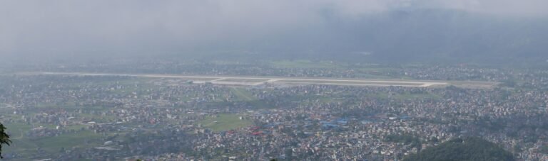
- Know the air alternative. Bharatpur is the nearest airport to the blocked stretch, and Kathmandu–Bharatpur flights have been used as a pressure valve in previous closures.
What it means for operators
For trekking and tour operators, the Ghoptebhir closure is a scheduling risk rather than a route risk. A coach that leaves Pokhara at dawn for Kathmandu can lose half a day; a group that arrives in Kathmandu the evening before a Lukla or Everest flight can lose the flight. Agencies running back-to-back circuits through Pokhara should build a spare half-day into transfers during the November–December window, and should hold the phone number of a jeep operator on the Chitwan side of the blockage.
There is also a client-communication point. Road closures in Nepal are frequent, short and poorly publicised in English. Telling travellers in advance that the Mugling–Narayangadh section can close without warning, and that the itinerary has slack for it, prevents the panic that follows a 4am message saying the road is shut.
What to watch next
Two things would change the picture. The first is any announcement of slope treatment at Ghoptebhir — scaling, netting or a protection structure — which would signal that the road project regards the upper slope, rather than the carriageway, as the problem. The second is the first sustained winter rain in the middle hills, which historically produces a fresh round of failures on slopes left loose by the monsoon.
Until then, the highway is open, the debris is cleared, and the hillside above Ghoptebhir is exactly as it was on Saturday. Sunday’s closure cost travellers a few hours. The next one may cost more if the road is busier, the light is worse, or the slope decides to move again. Sources: Onlinekhabar, The Annapurna Express, Nepalnews, Ratopati, Setopati, Drishti News.
Share this content: